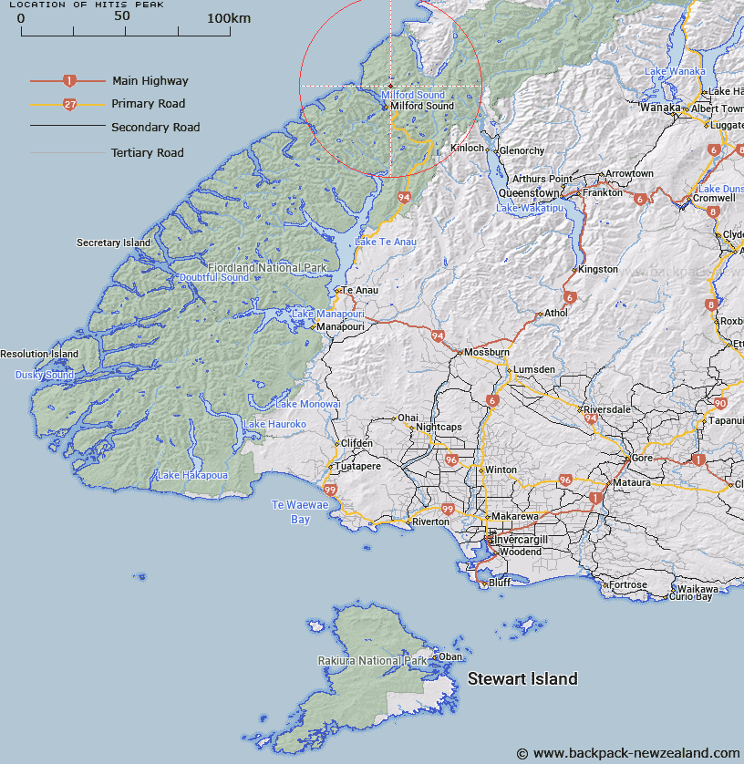
Map showing location of Mitis Peak


LINZ description: A small rocky outcrop at the head of the Bowen Valley, Milford Sound Survey District.
Latitude: -44.5875
Longitude: 167.941944
Northing: 5050413.8
Easting: 1198490
Land District: Southland
Feat Type: Hill


Scroll down to see a more detailed road map and below that a topographical map showing the location of Mitis Peak. The road map has been supplied by openstreetmap and the topographical map of Mitis Peak has been supplied by Land Information New Zealand (LINZ).

Yes you can use the top static map for you school/university project or personal website with a link back. Contact me for any commercial use.

Mitis Peak Map New Zealand


New Zealand places in our database
[ A ] [ B ] [ C ] [ D ] [ E ] [ F ] [ G ] [ H ] [ I ] [ J ] [ K ] [ L ] [ M ] [ N ] [ O ] [ P ] [ Q ] [ R ] [ S ] [ T ] [ U ] [ V ] [ W ] [ X ] [ Y ] [ Z ]


Closest 20 Hills to Mitis Peak

Grave Mountain ( 1.04km )   Benton Peak ( 2.61km )   Mills Peak ( 2.95km )   Paranui Peak ( 3.44km )   Troglodyte ( 4.22km )   Te Hau ( 4.68km )   Hupokeka ( 4.96km )   Mount Pembroke ( 4.96km )   Parariki Peak ( 4.98km )   Little Matterhorn ( 4.99km )   The Lion ( 5.21km )   Ongaruanuku ( 5.5km )   Mount Tutoko ( 5.63km )   Halfway Peak ( 5.78km )   The Elephant ( 6.51km )   Rover Peak ( 6.9km )   Alice Peak ( 7.73km )   Barren Peak ( 8.24km )   Mount Mahere ( 8.25km )   Mount Milne ( 8.27km )   Footstool ( 8.27km )   Mount Tarewai ( 8.28km )   Mount Syme ( 8.38km )   Mitre Peak ( 8.45km )   Puketuroto Peak ( 8.61km )   Bowen Hill ( 8.64km )   Mount Madeline ( 8.74km )   Waitiri ( 8.91km )   Mount Dot ( 9.08km )   Mount Philipps ( 10km )   Mount Phillips ( 10km )   Mount Thunder ( 10.14km )   Mount Underwood ( 10.72km )   Mount Barton ( 10.99km )   Patuki Mountain ( 11.1km )   Mount Richardson ( 11.6km )   Te Wera Peak ( 11.88km )   Devils Armchair ( 12.02km )   Sheerdown Peak ( 12.42km )   Karetai Peak ( 12.51km )