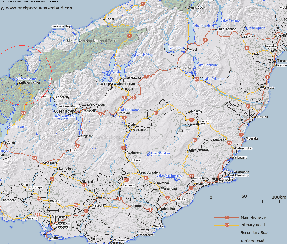
Map showing location of Paranui Peak


LINZ description: Peak north-west of Mount Tutoko, at the head of the Tutoko River and the Donne Glacier.
Latitude: -44.571254
Longitude: 167.978881
Northing: 5052400
Easting: 1201310.8
Land District: Otago
Feat Type: Hill


Scroll down to see a more detailed road map and below that a topographical map showing the location of Paranui Peak. The road map has been supplied by openstreetmap and the topographical map of Paranui Peak has been supplied by Land Information New Zealand (LINZ).

Yes you can use the top static map for you school/university project or personal website with a link back. Contact me for any commercial use.

Paranui Peak Map New Zealand


New Zealand places in our database
[ A ] [ B ] [ C ] [ D ] [ E ] [ F ] [ G ] [ H ] [ I ] [ J ] [ K ] [ L ] [ M ] [ N ] [ O ] [ P ] [ Q ] [ R ] [ S ] [ T ] [ U ] [ V ] [ W ] [ X ] [ Y ] [ Z ]


Closest 20 Hills to Paranui Peak

Troglodyte ( 1.06km )   Parariki Peak ( 1.55km )   Halfway Peak ( 2.34km )   Grave Mountain ( 3.08km )   Ongaruanuku ( 3.22km )   Mitis Peak ( 3.44km )   Mount Tutoko ( 3.71km )   Alice Peak ( 4.99km )   Puketuroto Peak ( 5.17km )   Te Hau ( 5.41km )   Benton Peak ( 5.83km )   Mount Dot ( 5.85km )   Mills Peak ( 6.06km )   Mount Thunder ( 6.99km )   Mount Madeline ( 7.13km )   Mount Pembroke ( 7.4km )   Mount Syme ( 7.5km )   Mount Milne ( 7.59km )   Mount Tarewai ( 7.75km )   Mount Mahere ( 7.86km )   Little Matterhorn ( 8.06km )   Hupokeka ( 8.2km )   The Lion ( 8.64km )   Waitiri ( 8.75km )   The Elephant ( 9.67km )   Rover Peak ( 9.96km )   Barren Peak ( 10.26km )   Mount Richardson ( 10.79km )   Mount Barton ( 10.88km )   Bowen Hill ( 11.03km )   Te Wera Peak ( 11.38km )   Patuki Mountain ( 11.44km )   Mount Underwood ( 11.52km )   Footstool ( 11.58km )   Mitre Peak ( 11.88km )   Karetai Peak ( 12.42km )   Mount Terres ( 12.61km )   Mount Sutherland ( 13.04km )   Mount Philipps ( 13.09km )   Mount Phillips ( 13.09km )