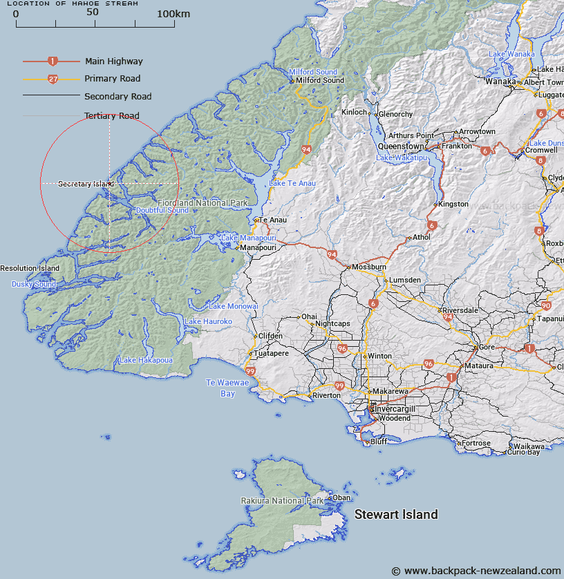
Map showing location of Mahoe Stream


LINZ description: Stream on Secretary Island, flowing North-westward from the northern slopes of All Round Peak to western coast, 2.4km North-east of South West Point.
Latitude: -45.218146
Longitude: 166.907428
Northing: 4974729.5
Easting: 1121644.6
Land District: Southland
Feat Type: Stream


Scroll down to see a more detailed road map and below that a topographical map showing the location of Mahoe Stream. The road map has been supplied by openstreetmap and the topographical map of Mahoe Stream has been supplied by Land Information New Zealand (LINZ).

Yes you can use the top static map for you school/university project or personal website with a link back. Contact me for any commercial use.

Mahoe Stream Map New Zealand


New Zealand places in our database
[ A ] [ B ] [ C ] [ D ] [ E ] [ F ] [ G ] [ H ] [ I ] [ J ] [ K ] [ L ] [ M ] [ N ] [ O ] [ P ] [ Q ] [ R ] [ S ] [ T ] [ U ] [ V ] [ W ] [ X ] [ Y ] [ Z ]


Closest 20 Streams to Mahoe Stream

Mahoe Stream ( 0km )   Astelia Stream ( 2.7km )   Hub Creek ( 5.25km )   Crayfish Creek ( 7.56km )   Pandora River ( 9.1km )   Namu River ( 10.2km )   Rum River ( 15.22km )   Toddy Burn ( 16.11km )   Rea River ( 20.52km )   Windward River ( 23.96km )   Jacobs Creek ( 25.14km )   Misty River ( 25.26km )   Camelot River ( 26.01km )   Juno River ( 26.94km )   Elizabeth River ( 28.99km )   Irene River ( 29.75km )   Elaine Stream ( 31.14km )   Cozette Burn ( 31.16km )   Tuaraki Stream ( 31.69km )   Anehu Stream ( 31.86km )   Torre Stream ( 33.08km )   Adams Burn ( 34.63km )   Coal River ( 34.81km )   Omaki Stream ( 34.89km )   Gilmour Burn ( 35.48km )   Forster Burn ( 35.96km )   Stella Burn ( 36.09km )   Lyvia River ( 36.44km )   Philipson Burn ( 36.48km )   Freeman Burn ( 36.67km )   Expectation Stream ( 38.73km )   Wisely Burn ( 38.96km )   Stevens Burn ( 39.08km )   Gorge Burn ( 39.37km )   McKenzie Burn ( 39.77km )   Feldspar Stream ( 39.91km )   Mica Burn ( 40.05km )   Esk Burn ( 40.07km )   Wekawai Stream ( 40.15km )   Large Burn ( 40.18km )