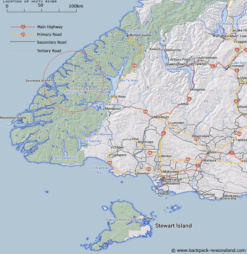
Map showing location of Misty River


LINZ description: River draining western slopes of Coronation Peak and flowing into Precipice Cove, Bradshaw Sound
Latitude: -45.229243
Longitude: 167.229554
Northing: 4975361.9
Easting: 1147023.8
Land District: Southland
Feat Type: Stream


Scroll down to see a more detailed road map and below that a topographical map showing the location of Misty River. The road map has been supplied by openstreetmap and the topographical map of Misty River has been supplied by Land Information New Zealand (LINZ).

Yes you can use the top static map for you school/university project or personal website with a link back. Contact me for any commercial use.

Misty River Map New Zealand


New Zealand places in our database
[ A ] [ B ] [ C ] [ D ] [ E ] [ F ] [ G ] [ H ] [ I ] [ J ] [ K ] [ L ] [ M ] [ N ] [ O ] [ P ] [ Q ] [ R ] [ S ] [ T ] [ U ] [ V ] [ W ] [ X ] [ Y ] [ Z ]


Closest 20 Streams to Misty River

Rea River ( 4.73km )   Windward River ( 6.54km )   Cozette Burn ( 7.32km )   Camelot River ( 8.85km )   Toddy Burn ( 9.18km )   Tuaraki Stream ( 9.35km )   Adams Burn ( 9.63km )   Rum River ( 10.17km )   Torre Stream ( 10.68km )   Forster Burn ( 10.72km )   Philipson Burn ( 11.56km )   Irene River ( 13.31km )   Elaine Stream ( 13.66km )   Wisely Burn ( 13.78km )   McKenzie Burn ( 14.68km )   Anehu Stream ( 15km )   Omaki Stream ( 15.02km )   Esk Burn ( 15.34km )   Gorge Burn ( 15.49km )   Gilmour Burn ( 16.49km )   Freeman Burn ( 16.57km )   Pandora River ( 17.04km )   Jennings Burn ( 17.55km )   Namu River ( 17.59km )   Crayfish Creek ( 17.72km )   Stevens Burn ( 18.97km )   Delta Burn ( 19.07km )   Junction Burn ( 19.54km )   Large Burn ( 19.86km )   Waterfall Creek ( 20.11km )   Juno River ( 20.91km )   Chester Burn ( 21.1km )   Woodrow Burn ( 21.53km )   Elizabeth River ( 21.57km )   Hub Creek ( 21.86km )   Astelia Stream ( 22.58km )   Doon River ( 22.58km )   Feldspar Stream ( 23.19km )   Campbell Creek ( 23.21km )   Plateau Creek ( 23.58km )