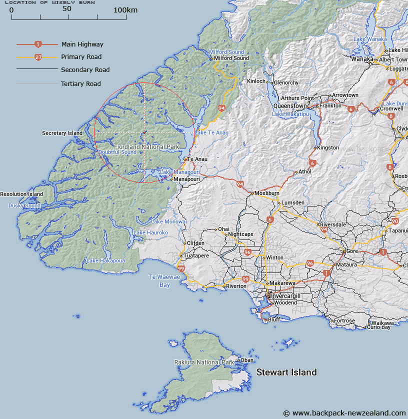
Map showing location of Wisely Burn


LINZ description: Stream flowing south-easterly from Lake Wisely to Lake Duncan.
Latitude: -45.218745
Longitude: 167.404812
Northing: 4977500
Easting: 1160700
Land District: Southland
Feat Type: Stream


Scroll down to see a more detailed road map and below that a topographical map showing the location of Wisely Burn. The road map has been supplied by openstreetmap and the topographical map of Wisely Burn has been supplied by Land Information New Zealand (LINZ).

Yes you can use the top static map for you school/university project or personal website with a link back. Contact me for any commercial use.

Wisely Burn Map New Zealand


New Zealand places in our database
[ A ] [ B ] [ C ] [ D ] [ E ] [ F ] [ G ] [ H ] [ I ] [ J ] [ K ] [ L ] [ M ] [ N ] [ O ] [ P ] [ Q ] [ R ] [ S ] [ T ] [ U ] [ V ] [ W ] [ X ] [ Y ] [ Z ]


Closest 20 Streams to Wisely Burn

Forster Burn ( 3.9km )   McKenzie Burn ( 4.59km )   Philipson Burn ( 5.74km )   Jennings Burn ( 6.16km )   Adams Burn ( 6.19km )   Esk Burn ( 6.89km )   Woodrow Burn ( 8.13km )   Chester Burn ( 8.27km )   Junction Burn ( 8.33km )   Gorge Burn ( 9.75km )   Waterfall Creek ( 9.77km )   Plateau Creek ( 10.12km )   Cozette Burn ( 10.46km )   Delta Burn ( 11.78km )   Torre Stream ( 12.19km )   Doon River ( 12.34km )   Tuaraki Stream ( 12.38km )   Lyall Burn ( 12.89km )   Misty River ( 13.78km )   Snag Burn ( 14.26km )   William Burn ( 14.34km )   Large Burn ( 14.53km )   Campbell Creek ( 14.67km )   McIvor Burn ( 15.13km )   Pisgah Creek ( 15.18km )   Lake Creek ( 16.16km )   Windward River ( 16.37km )   Omaki Stream ( 16.49km )   Irene River ( 16.78km )   Freeman Burn ( 16.79km )   Tutu Burn ( 17.27km )   Mystery Burn ( 17.31km )   Ettrick Burn ( 17.77km )   Stevens Burn ( 17.89km )   Camelot River ( 17.92km )   Sheerwall Creek ( 18.03km )   Gilmour Burn ( 18.08km )   Rea River ( 18.48km )   Elaine Stream ( 18.61km )   Point Burn ( 19km )