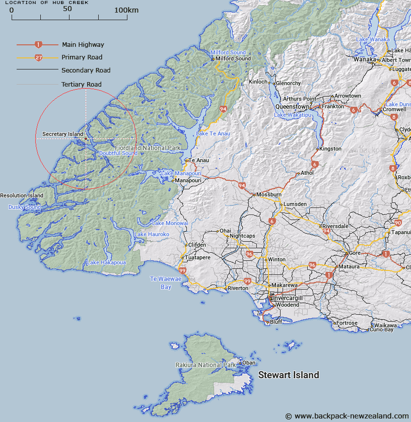
Map showing location of Hub Creek


LINZ description: Stream on Secretary Island, flowing North-eastward from the eastern slopes of The Hub to Thompson Sound, 1km South of Phillips Point.
Latitude: -45.253173
Longitude: 166.952464
Northing: 4971105.4
Easting: 1125473.2
Land District: Southland
Feat Type: Stream


Scroll down to see a more detailed road map and below that a topographical map showing the location of Hub Creek. The road map has been supplied by openstreetmap and the topographical map of Hub Creek has been supplied by Land Information New Zealand (LINZ).

Yes you can use the top static map for you school/university project or personal website with a link back. Contact me for any commercial use.

Hub Creek Map New Zealand


New Zealand places in our database
[ A ] [ B ] [ C ] [ D ] [ E ] [ F ] [ G ] [ H ] [ I ] [ J ] [ K ] [ L ] [ M ] [ N ] [ O ] [ P ] [ Q ] [ R ] [ S ] [ T ] [ U ] [ V ] [ W ] [ X ] [ Y ] [ Z ]


Closest 20 Streams to Hub Creek

Astelia Stream ( 4.14km )   Crayfish Creek ( 5.05km )   Mahoe Stream ( 5.25km )   Pandora River ( 8.41km )   Namu River ( 10.44km )   Rum River ( 11.71km )   Toddy Burn ( 12.77km )   Rea River ( 17.22km )   Camelot River ( 21.37km )   Jacobs Creek ( 21.39km )   Windward River ( 21.81km )   Misty River ( 21.86km )   Elizabeth River ( 23.74km )   Elaine Stream ( 26.24km )   Anehu Stream ( 26.9km )   Cozette Burn ( 27.09km )   Tuaraki Stream ( 27.34km )   Juno River ( 27.63km )   Irene River ( 28.51km )   Torre Stream ( 28.67km )   Omaki Stream ( 30.11km )   Gilmour Burn ( 30.59km )   Adams Burn ( 30.84km )   Stella Burn ( 30.88km )   Lyvia River ( 31.36km )   Freeman Burn ( 31.86km )   Forster Burn ( 32.37km )   Philipson Burn ( 32.62km )   Coal River ( 32.87km )   Stevens Burn ( 34.23km )   Mica Burn ( 34.81km )   Wekawai Stream ( 35.01km )   Disaster Burn ( 35.02km )   Awe Burn ( 35.03km )   Gorge Burn ( 35.09km )   Oonah Burn ( 35.59km )   Wisely Burn ( 35.63km )   McKenzie Burn ( 35.97km )   Esk Burn ( 36.05km )   Dashwood Stream ( 36.62km )