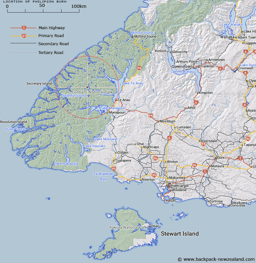
Map showing location of Philipson Burn


LINZ description: Flows north-easterly into Lake Te Anau near southern end of that Lake. Esk Survey District.
Latitude: -45.263726
Longitude: 167.368899
Northing: 4972306.4
Easting: 1158230.2
Land District: Southland
Feat Type: Stream


Scroll down to see a more detailed road map and below that a topographical map showing the location of Philipson Burn. The road map has been supplied by openstreetmap and the topographical map of Philipson Burn has been supplied by Land Information New Zealand (LINZ).

Yes you can use the top static map for you school/university project or personal website with a link back. Contact me for any commercial use.

Philipson Burn Map New Zealand


New Zealand places in our database
[ A ] [ B ] [ C ] [ D ] [ E ] [ F ] [ G ] [ H ] [ I ] [ J ] [ K ] [ L ] [ M ] [ N ] [ O ] [ P ] [ Q ] [ R ] [ S ] [ T ] [ U ] [ V ] [ W ] [ X ] [ Y ] [ Z ]


Closest 20 Streams to Philipson Burn

Adams Burn ( 1.94km )   Forster Burn ( 2.63km )   McKenzie Burn ( 3.4km )   Esk Burn ( 3.82km )   Gorge Burn ( 5.13km )   Cozette Burn ( 5.73km )   Wisely Burn ( 5.74km )   Torre Stream ( 6.55km )   Tuaraki Stream ( 6.96km )   Delta Burn ( 8.3km )   Waterfall Creek ( 8.56km )   Chester Burn ( 10.02km )   Omaki Stream ( 10.76km )   Freeman Burn ( 11.16km )   Misty River ( 11.56km )   Jennings Burn ( 11.88km )   Gilmour Burn ( 12.37km )   Stevens Burn ( 12.5km )   Plateau Creek ( 12.89km )   Elaine Stream ( 12.96km )   Camelot River ( 13.07km )   Woodrow Burn ( 13.29km )   Anehu Stream ( 13.94km )   Junction Burn ( 14.07km )   William Burn ( 14.27km )   Tutu Burn ( 14.66km )   Lyall Burn ( 14.75km )   Rea River ( 16.16km )   Windward River ( 16.27km )   Iris Burn ( 16.39km )   Sheerwall Creek ( 17.76km )   Lake Creek ( 17.92km )   Doon River ( 18.07km )   Mystery Burn ( 18.08km )   Snag Burn ( 18.65km )   Irene River ( 19.19km )   Wekawai Stream ( 19.3km )   Large Burn ( 19.5km )   Awe Burn ( 19.73km )   Ettrick Burn ( 20.22km )