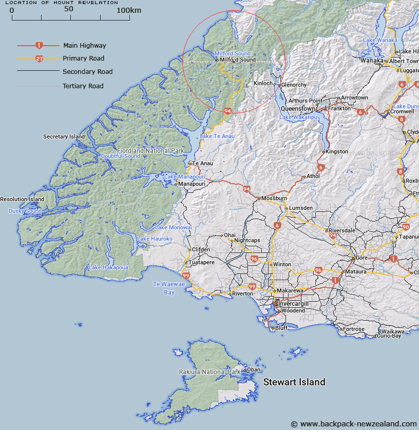
Map showing location of Mount Revelation


LINZ description: Mountain north of Lake Adelaide, Central Darran Mountains above Korako Glacier and Donne River.
Latitude: -44.681435
Longitude: 168.048703
Northing: 5040500
Easting: 1207600
Land District: Southland
Feat Type: Hill


Scroll down to see a more detailed road map and below that a topographical map showing the location of Mount Revelation. The road map has been supplied by openstreetmap and the topographical map of Mount Revelation has been supplied by Land Information New Zealand (LINZ).

Yes you can use the top static map for you school/university project or personal website with a link back. Contact me for any commercial use.

Mount Revelation Map New Zealand


New Zealand places in our database
[ A ] [ B ] [ C ] [ D ] [ E ] [ F ] [ G ] [ H ] [ I ] [ J ] [ K ] [ L ] [ M ] [ N ] [ O ] [ P ] [ Q ] [ R ] [ S ] [ T ] [ U ] [ V ] [ W ] [ X ] [ Y ] [ Z ]


Closest 20 Hills to Mount Revelation

Karetai Peak ( 1.04km )   Taiaroa Peak ( 1.07km )   Apirana Peak ( 1.93km )   Tuhawaiki Mountain ( 2.2km )   Patuki Mountain ( 2.5km )   Te Wera Peak ( 2.6km )   Mihj Peak ( 3.67km )   Mount Underwood ( 3.68km )   The Twins ( 4.54km )   Waitiri ( 4.7km )   The Sentinel ( 4.98km )   High Peak ( 5.26km )   Mount Gifford ( 5.36km )   Third Peak ( 5.36km )   East Peak ( 5.38km )   Mount Mahere ( 5.59km )   Mount Tarewai ( 5.73km )   Low Peak ( 5.76km )   Mount Milne ( 5.95km )   Mount Syme ( 6.19km )   Barrier Knob ( 6.75km )   Adelaide Peak ( 7.22km )   Sabre Peak ( 7.32km )   Marian Peak ( 7.45km )   Mount Madeline ( 7.48km )   Barrier Peak ( 7.63km )   Barren Peak ( 8.07km )   Mount Gunn ( 8.63km )   Mount Lippe ( 8.71km )   Mount Talbot ( 8.71km )   Sheerdown Peak ( 8.9km )   Mount Isolation ( 8.97km )   Bowen Hill ( 9.3km )   East Peak ( 9.38km )   Mount McPherson ( 9.42km )   Middle Peak ( 9.45km )   Second Peak ( 9.46km )   West Peak ( 9.71km )   Mount Tutoko ( 10.08km )   Cockburn Incline ( 10.24km )