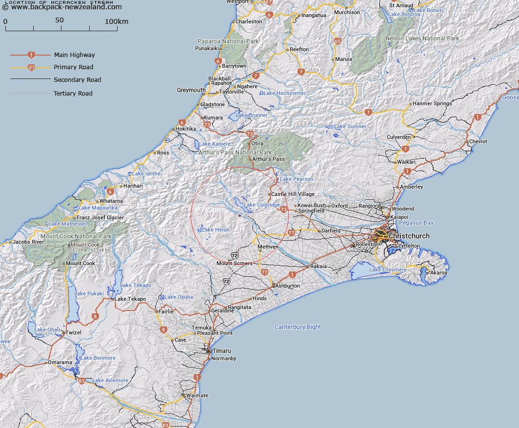
Map showing location of McCracken Stream


LINZ description: Right Bank tributary of Rakaia River rising 2.5km North of Black Hill [Trig. Black Hill No 2 (Geodetic Code 1412)], flowing westward and joining Rakaia River 1.8km North-east of Redcliffe Homestead. Blocks X and XI, Glenrock Survey District
Latitude: -43.371852
Longitude: 171.484442
Northing: 5196775
Easting: 1477216
Land District: Canterbury
Feat Type: Stream


Scroll down to see a more detailed road map and below that a topographical map showing the location of McCracken Stream. The road map has been supplied by openstreetmap and the topographical map of McCracken Stream has been supplied by Land Information New Zealand (LINZ).

Yes you can use the top static map for you school/university project or personal website with a link back. Contact me for any commercial use.

McCracken Stream Map New Zealand


New Zealand places in our database
[ A ] [ B ] [ C ] [ D ] [ E ] [ F ] [ G ] [ H ] [ I ] [ J ] [ K ] [ L ] [ M ] [ N ] [ O ] [ P ] [ Q ] [ R ] [ S ] [ T ] [ U ] [ V ] [ W ] [ X ] [ Y ] [ Z ]


Closest 20 Streams to McCracken Stream

Packers Creek ( 2.57km )   Jack Stream ( 3.41km )   Redcliffe Stream ( 3.68km )   Cardinal Stream ( 5.81km )   Donald Stream ( 5.85km )   Comyns Stream ( 7.59km )   Ensor Stream ( 8.12km )   Hutt Stream ( 8.12km )   Snowy Stream ( 9.51km )   Glenrock Stream ( 10.03km )   Turtons Stream ( 10.24km )   Simois Stream ( 10.29km )   Scamander Stream ( 10.49km )   Coleridge Stream ( 10.57km )   Acheron River ( 11.03km )   Middle Creek ( 11.03km )   Little River ( 11.23km )   Dry Acheron Stream ( 11.24km )   Swift River ( 11.32km )   Gerard Stream ( 12.67km )   Petticoat Lane ( 12.82km )   Hennah Stream ( 13.15km )   Glenariffe Stream ( 14.12km )   McLennan Creek ( 14.25km )   Pudding Hill Stream ( 14.33km )   Ryton River ( 14.6km )   Barnard Stream ( 14.61km )   Ben More Stream ( 14.71km )   Kings Drive Stream ( 14.73km )   Colonel Stream ( 15.28km )   Double Hill Stream ( 15.47km )   Idaburn ( 15.72km )   Round Hill Creek ( 16.05km )   Logan Stream ( 16.07km )   Goldney River ( 16.39km )   Lake Stream ( 16.55km )   Ford Stream ( 16.62km )   Harper River Diversion ( 16.73km )   Moss Burn ( 16.83km )   Oakden Canal ( 16.9km )