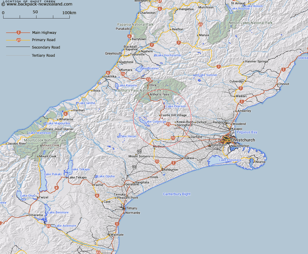
Map showing location of Ghost Creek


LINZ description: Flows north-west from Torlesse Range, South-west of Castle Hill Peak, into Porter River on the right bank, 1km below Whitewater Stream. Kowai Survey District.
Latitude: -43.244387
Longitude: 171.748655
Northing: 5211285.8
Easting: 1498409.6
Land District: Canterbury
Feat Type: Stream


Scroll down to see a more detailed road map and below that a topographical map showing the location of Ghost Creek. The road map has been supplied by openstreetmap and the topographical map of Ghost Creek has been supplied by Land Information New Zealand (LINZ).

Yes you can use the top static map for you school/university project or personal website with a link back. Contact me for any commercial use.

Ghost Creek Map New Zealand


New Zealand places in our database
[ A ] [ B ] [ C ] [ D ] [ E ] [ F ] [ G ] [ H ] [ I ] [ J ] [ K ] [ L ] [ M ] [ N ] [ O ] [ P ] [ Q ] [ R ] [ S ] [ T ] [ U ] [ V ] [ W ] [ X ] [ Y ] [ Z ]


Closest 20 Streams to Ghost Creek

Adams Stream ( 2.91km )   Camp Stream ( 2.91km )   Dry Stream ( 3.08km )   Blackley Stream ( 3.28km )   Foggy Stream ( 4.55km )   Thomas River ( 4.8km )   Emu Stream ( 5.1km )   Whitewater Stream ( 5.68km )   Enys Stream ( 5.72km )   Flock Hill Stream ( 5.86km )   Porter River ( 6.05km )   Hogs Back Creek ( 6.64km )   Coach Stream ( 6.66km )   Kowai River ( 6.69km )   Macfarlane Stream ( 7.84km )   Milliken Stream ( 8.4km )   Iron Creek ( 8.48km )   Long Creek ( 8.5km )   Parker Stream ( 8.87km )   Otarama Stream ( 9.17km )   Lansdowne Creek ( 9.28km )   Tims Stream ( 9.54km )   Waterfall Creek ( 9.64km )   Cuckoo Creek ( 10.1km )   Rata Stream ( 10.31km )   Rubicon River ( 10.63km )   Little Kowai River ( 10.72km )   Ede Stream ( 10.76km )   Nomans Stream ( 11.39km )   Wall Creek ( 11.41km )   Broken River ( 11.5km )   Winding Creek ( 11.77km )   Camp Stream ( 12.13km )   Goldney River ( 12.24km )   Craigieburn ( 12.33km )   Thirteen Mile Bush Stream ( 12.35km )   Manson Creek ( 12.85km )   Paterson Stream ( 13.1km )   Patterson Stream ( 13.1km )   Rocky Stream ( 13.57km )