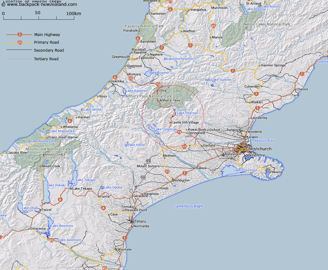
Map showing location of Manson Creek


LINZ description: Flows south-east from Mount Manson into Craigieburn, near the bottom of Coal Pit Spur. Grasmere Survey District.
Latitude: -43.12885
Longitude: 171.750739
Northing: 5224119.1
Easting: 1498387.3
Land District: Canterbury
Feat Type: Stream


Scroll down to see a more detailed road map and below that a topographical map showing the location of Manson Creek. The road map has been supplied by openstreetmap and the topographical map of Manson Creek has been supplied by Land Information New Zealand (LINZ).

Yes you can use the top static map for you school/university project or personal website with a link back. Contact me for any commercial use.

Manson Creek Map New Zealand


New Zealand places in our database
[ A ] [ B ] [ C ] [ D ] [ E ] [ F ] [ G ] [ H ] [ I ] [ J ] [ K ] [ L ] [ M ] [ N ] [ O ] [ P ] [ Q ] [ R ] [ S ] [ T ] [ U ] [ V ] [ W ] [ X ] [ Y ] [ Z ]


Closest 20 Streams to Manson Creek

Craigieburn ( 1.45km )   Ribbonwood Stream ( 4.06km )   Camp Stream ( 4.13km )   Rata Stream ( 4.35km )   Broken River ( 4.65km )   Bernard Stream ( 5.01km )   Wall Creek ( 5.93km )   Winding Creek ( 6.11km )   Cuckoo Creek ( 6.28km )   Long Valley Stream ( 7.29km )   Flock Hill Stream ( 7.59km )   Snowslide Stream ( 7.59km )   Slovens Stream ( 7.65km )   Tims Stream ( 7.93km )   Hamilton Creek ( 8.05km )   Milliken Stream ( 8.15km )   Cass River ( 8.28km )   Hogs Back Creek ( 8.53km )   McLeod Stream ( 8.88km )   Waterfall Creek ( 9.44km )   Thomas River ( 9.73km )   Long Creek ( 9.78km )   Cockayne Creek ( 9.87km )   Fall Creek ( 10.19km )   Misery Stream ( 10.33km )   Doubtful Creek ( 10.41km )   Nomans Stream ( 10.56km )   Camp Stream ( 10.69km )   Adams Stream ( 10.69km )   Iron Creek ( 10.78km )   Hut Creek ( 10.82km )   Grasmere Stream ( 11.06km )   Emu Stream ( 11.13km )   Blackley Stream ( 11.26km )   Poverty Stream ( 11.3km )   Gooseberry Stream ( 11.54km )   Mangos Creek ( 11.77km )   Puffers Stream ( 11.77km )   McKay Stream ( 12.03km )   Lansdowne Creek ( 12.18km )