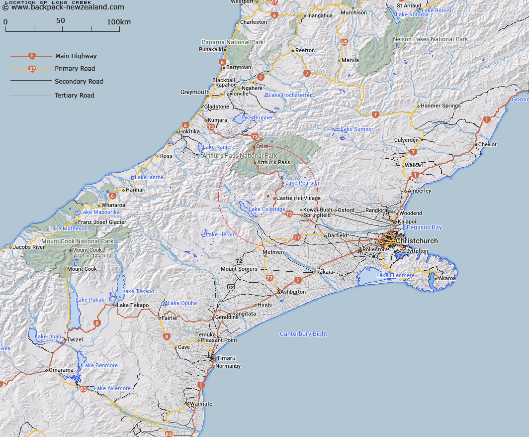
Map showing location of Long Creek


LINZ description: Southern branch of Hogs Back Creek, rising below and to the North of Mount Cloudsley, flowing North of Long Spur. Harper Survey District.
Latitude: -43.194029
Longitude: 171.669726
Northing: 5216779.3
Easting: 1491912.7
Land District: Canterbury
Feat Type: Stream


Scroll down to see a more detailed road map and below that a topographical map showing the location of Long Creek. The road map has been supplied by openstreetmap and the topographical map of Long Creek has been supplied by Land Information New Zealand (LINZ).

Yes you can use the top static map for you school/university project or personal website with a link back. Contact me for any commercial use.

Long Creek Map New Zealand


New Zealand places in our database
[ A ] [ B ] [ C ] [ D ] [ E ] [ F ] [ G ] [ H ] [ I ] [ J ] [ K ] [ L ] [ M ] [ N ] [ O ] [ P ] [ Q ] [ R ] [ S ] [ T ] [ U ] [ V ] [ W ] [ X ] [ Y ] [ Z ]


Closest 20 Streams to Long Creek

Waterfall Creek ( 1.21km )   Tims Stream ( 2.09km )   Hogs Back Creek ( 2.49km )   Cuckoo Creek ( 3.72km )   Thomas River ( 3.82km )   Whitewater Stream ( 4.08km )   Wall Creek ( 4.77km )   Enys Stream ( 5.05km )   Hut Creek ( 5.57km )   Broken River ( 5.71km )   Camp Stream ( 6.5km )   Cockayne Creek ( 6.64km )   Hidden Creek ( 7.79km )   Porter River ( 7.85km )   Dry Stream ( 8.05km )   Flock Hill Stream ( 8.45km )   Craigieburn ( 8.49km )   Ghost Creek ( 8.5km )   Goldney River ( 8.5km )   Hamilton Creek ( 8.59km )   Camp Stream ( 8.85km )   Adams Stream ( 8.85km )   Monckburn ( 8.91km )   Corner Creek ( 9.21km )   Catherine Stream ( 9.34km )   Manson Creek ( 9.78km )   Blackley Stream ( 9.83km )   Fall Creek ( 10.32km )   Rata Stream ( 10.52km )   Tarn Creek ( 10.71km )   Ryton River ( 10.99km )   Idaburn ( 11.06km )   Emu Stream ( 11.23km )   Milliken Stream ( 11.73km )   Doubtful Creek ( 12.01km )   Centre Creek ( 12.21km )   Ribbonwood Stream ( 12.47km )   Foggy Stream ( 12.77km )   Winding Creek ( 13km )   Hennah Stream ( 13km )