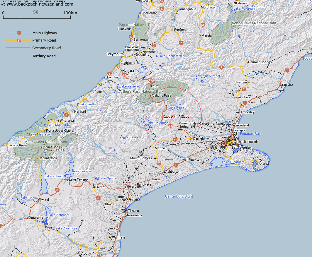
Map showing location of Lansdowne Creek


LINZ description: Stream flowing North from Back Peak and Otarama Peak, West of Lansdowne Spur, into Broken River. Grasmere & Kowai Survey Districts.
Latitude: -43.209331
Longitude: 171.852661
Northing: 5215300
Easting: 1506800
Land District: Canterbury
Feat Type: Stream


Scroll down to see a more detailed road map and below that a topographical map showing the location of Lansdowne Creek. The road map has been supplied by openstreetmap and the topographical map of Lansdowne Creek has been supplied by Land Information New Zealand (LINZ).

Yes you can use the top static map for you school/university project or personal website with a link back. Contact me for any commercial use.

Lansdowne Creek Map New Zealand


New Zealand places in our database
[ A ] [ B ] [ C ] [ D ] [ E ] [ F ] [ G ] [ H ] [ I ] [ J ] [ K ] [ L ] [ M ] [ N ] [ O ] [ P ] [ Q ] [ R ] [ S ] [ T ] [ U ] [ V ] [ W ] [ X ] [ Y ] [ Z ]


Closest 20 Streams to Lansdowne Creek

Iron Creek ( 1.49km )   Ede Stream ( 1.49km )   Otarama Stream ( 2.85km )   Nomans Stream ( 3.18km )   Milliken Stream ( 4.08km )   Emu Stream ( 4.23km )   Rocky Stream ( 4.43km )   Truscotts Stream ( 4.63km )   Blakistons Stream ( 4.86km )   Chasm Stream ( 5.19km )   Puffers Stream ( 5.75km )   Blackley Stream ( 6.08km )   Flock Hill Stream ( 6.58km )   Adams Stream ( 6.81km )   Camp Stream ( 6.81km )   Paterson Stream ( 6.86km )   Patterson Stream ( 6.86km )   Winding Creek ( 6.95km )   Rata Stream ( 7.84km )   Joyces Stream ( 7.92km )   Waterfall Creek ( 8.02km )   Waterfall Stream ( 8.03km )   Kinnebrooks Stream ( 8.23km )   Ghost Creek ( 9.28km )   Little Kowai River ( 9.3km )   Bernard Stream ( 9.49km )   Broadleaf Stream ( 9.84km )   Foggy Stream ( 10.4km )   Foster Stream ( 10.72km )   Rubicon River ( 11.04km )   Thomas River ( 11.52km )   Coal Creek ( 11.78km )   Kowai River ( 12.06km )   Manson Creek ( 12.18km )   Dry Stream ( 12.36km )   Hogs Back Creek ( 12.44km )   Craigieburn ( 12.74km )   Slovens Stream ( 13.05km )   Coach Stream ( 13.4km )   Whitewater Stream ( 14.05km )