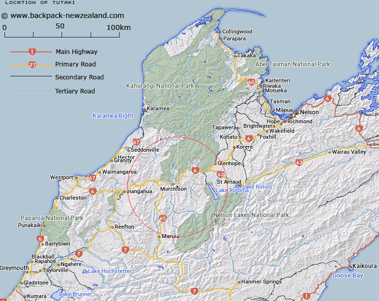
Map showing location of Tutaki


LINZ description: South-east of Muchison on a height of 953m.
Latitude: -41.820987
Longitude: 172.358214
Northing: 5369900
Easting: 1546700
Land District: Nelson
Feat Type: Trig Station


Scroll down to see a more detailed road map and below that a topographical map showing the location of Tutaki. The road map has been supplied by openstreetmap and the topographical map of Tutaki has been supplied by Land Information New Zealand (LINZ).

Yes you can use the top static map for you school/university project or personal website with a link back. Contact me for any commercial use.

Tutaki Map New Zealand


New Zealand places in our database
[ A ] [ B ] [ C ] [ D ] [ E ] [ F ] [ G ] [ H ] [ I ] [ J ] [ K ] [ L ] [ M ] [ N ] [ O ] [ P ] [ Q ] [ R ] [ S ] [ T ] [ U ] [ V ] [ W ] [ X ] [ Y ] [ Z ]


Closest 20 Trig Stations to Tutaki

Nestor ( 36.13km )   Korere ( 48.54km )   Faerie Queene ( 50.95km )   Kohatu ( 57.05km )   Dovedale ( 74.07km )   Haycock ( 86.97km )   Mount Saul ( 91.96km )   Flintoff ( 109.64km )   Flintoft ( 109.64km )   Murray Peak ( 110.9km )   Mount Pisgah ( 110.9km )   Pahau ( 114.28km )   Weka ( 135.08km )   Dukeshead ( 135.64km )   Matapehe ( 136.09km )   McLarens ( 136.09km )   Dumgree ( 137.95km )   Koiterangi ( 163.75km )   Kowhitirangi ( 163.75km )   Tara ( 184.66km )   Round Top ( 193km )   Tihiokahukura ( 198.42km )   Harris ( 200.09km )   Te Kopahou ( 202.76km )   Johnson Hill ( 207.26km )   Johnston Hill ( 207.26km )   Tawatawa ( 207.48km )   Vogeltown ( 208.57km )   Flag No. 2 ( 208.57km )   Etako ( 209.22km )   Witako ( 209.22km )   Flag No. 1 ( 209.76km )   Melrose ( 209.76km )   Rangoon Heights ( 213.14km )   Mount Misery ( 213.14km )   Ngahauranga ( 214.29km )   Ngauranga ( 214.29km )   Puketea ( 222.57km )   Pukeatea ( 222.57km )   Rabbit Hill ( 225.34km )