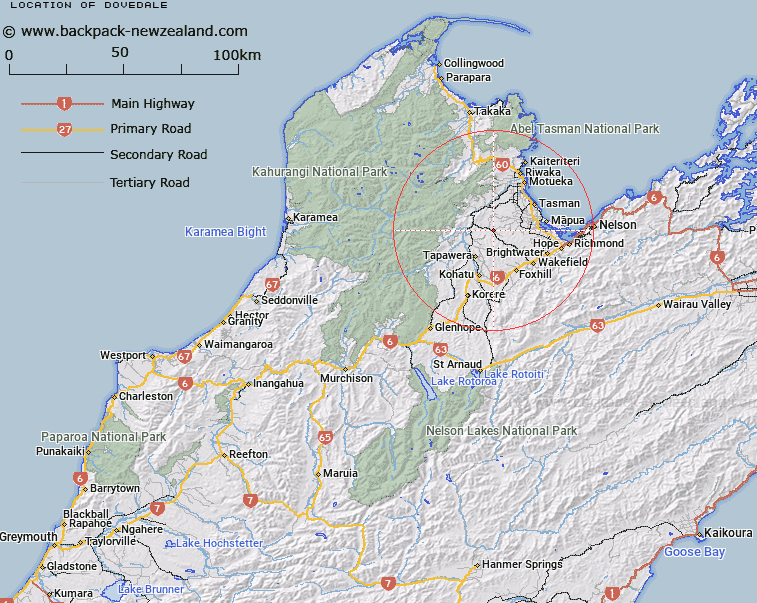
Map showing location of Dovedale


LINZ description: Geodetic Code BCYF at 157m height south west of locality Dovedale and north of Cozens Creek
Latitude: -41.289496
Longitude: 172.894903
Northing: 5429100
Easting: 1591200
Land District: Nelson
Feat Type: Trig Station


Scroll down to see a more detailed road map and below that a topographical map showing the location of Dovedale. The road map has been supplied by openstreetmap and the topographical map of Dovedale has been supplied by Land Information New Zealand (LINZ).

Yes you can use the top static map for you school/university project or personal website with a link back. Contact me for any commercial use.

Dovedale Map New Zealand


New Zealand places in our database
[ A ] [ B ] [ C ] [ D ] [ E ] [ F ] [ G ] [ H ] [ I ] [ J ] [ K ] [ L ] [ M ] [ N ] [ O ] [ P ] [ Q ] [ R ] [ S ] [ T ] [ U ] [ V ] [ W ] [ X ] [ Y ] [ Z ]


Closest 20 Trig Stations to Dovedale

Dovedale ( 0km )   Kohatu ( 18.92km )   Korere ( 27.96km )   Mount Pisgah ( 42.02km )   Murray Peak ( 42.02km )   Nestor ( 46.87km )   Haycock ( 61.79km )   McLarens ( 69.66km )   Matapehe ( 69.66km )   Tutaki ( 74.07km )   Dukeshead ( 81.27km )   Dumgree ( 98.79km )   Faerie Queene ( 112.86km )   Mount Saul ( 147.04km )   Te Kopahou ( 151.73km )   Johnston Hill ( 154.1km )   Johnson Hill ( 154.1km )   Tawatawa ( 156.21km )   Witako ( 156.52km )   Etako ( 156.52km )   Vogeltown ( 156.84km )   Flag No. 2 ( 156.84km )   Melrose ( 158.23km )   Flag No. 1 ( 158.23km )   Flintoft ( 158.63km )   Flintoff ( 158.63km )   Rangoon Heights ( 159.21km )   Mount Misery ( 159.21km )   Ngahauranga ( 160.57km )   Ngauranga ( 160.57km )   Pahau ( 167.84km )   Pukeatea ( 170.56km )   Puketea ( 170.56km )   Tuteremoana ( 176.34km )   Wainui (Whareroa) ( 178.41km )   Whareroa ( 178.41km )   Mangaroa ( 185.54km )   Bawbaw ( 186.96km )   Waiorongomai ( 189.26km )   Wairongomai ( 189.26km )