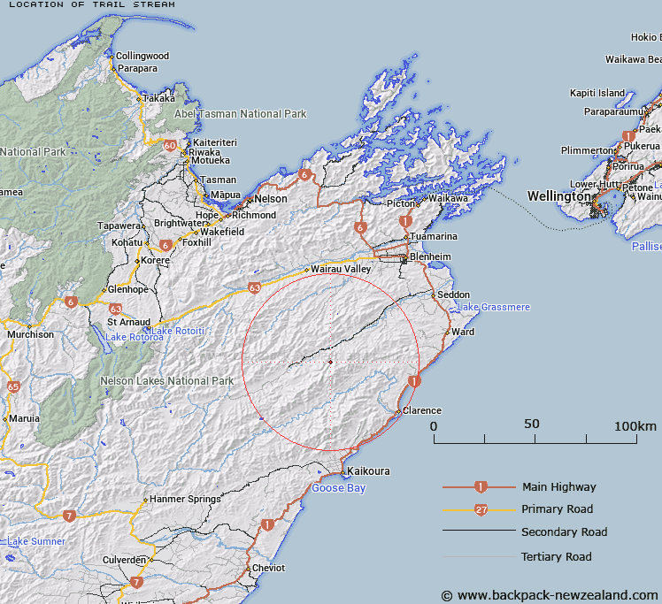
Map showing location of Trail Stream
LINZ description: Left bank tributary of Hodder River rising on the eastern slope of Mount Gladstone (Geodetic Code 1172), flowing North-eastward, and joining Hodder River 2.4km South-east of Hodder Peak [Trig. 9 (Geodetic Code A41Q)]. Blocks II, V and VI Tapuaenuku Survey District.
Latitude: -41.947175
Longitude: 173.633818
Northing: 5355894.6
Easting: 1652534.8
Land District: Marlborough
Feat Type: Stream
Latitude: -41.947175
Longitude: 173.633818
Northing: 5355894.6
Easting: 1652534.8
Land District: Marlborough
Feat Type: Stream

Scroll down to see a more detailed road map and below that a topographical map showing the location of Trail Stream. The road map has been supplied by openstreetmap and the topographical map of Trail Stream has been supplied by Land Information New Zealand (LINZ).
Yes you can use the top static map for you school/university project or personal website with a link back. Contact me for any commercial use.
[ A ] [ B ] [ C ] [ D ] [ E ] [ F ] [ G ] [ H ] [ I ] [ J ] [ K ] [ L ] [ M ] [ N ] [ O ] [ P ] [ Q ] [ R ] [ S ] [ T ] [ U ] [ V ] [ W ] [ X ] [ Y ] [ Z ]