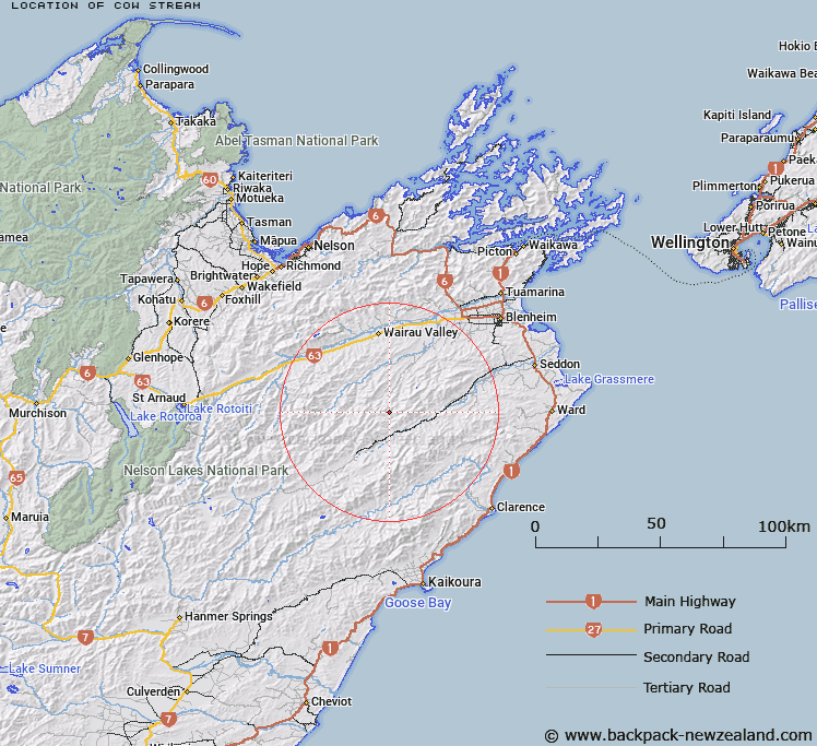
Map showing location of Cow Stream


LINZ description: Left bank tributary of Grey River rising approximately 900m East of Mount Delight, flowing southward, West of Rocky Gill Spur and joining Grey River 2.5km South-east of Mount Abrupt. Block XIV, Hodder Survey District.
Latitude: -41.830392
Longitude: 173.56601
Northing: 5368900
Easting: 1647000
Land District: Marlborough
Feat Type: Stream


Scroll down to see a more detailed road map and below that a topographical map showing the location of Cow Stream. The road map has been supplied by openstreetmap and the topographical map of Cow Stream has been supplied by Land Information New Zealand (LINZ).

Yes you can use the top static map for you school/university project or personal website with a link back. Contact me for any commercial use.

Cow Stream Map New Zealand


New Zealand places in our database
[ A ] [ B ] [ C ] [ D ] [ E ] [ F ] [ G ] [ H ] [ I ] [ J ] [ K ] [ L ] [ M ] [ N ] [ O ] [ P ] [ Q ] [ R ] [ S ] [ T ] [ U ] [ V ] [ W ] [ X ] [ Y ] [ Z ]


Closest 20 Streams to Cow Stream

Non Upton Brook ( 3.29km )   Tin Hut Stream ( 3.69km )   Grey River ( 4.82km )   Upton Brook ( 4.91km )   Burnt Country Creek ( 5.79km )   House Creek ( 5.87km )   Five Mile Stream ( 5.97km )   Ribble Stream ( 6.84km )   White Pine Stream ( 6.92km )   Clyde Stream ( 8.22km )   Pass Brook ( 8.42km )   Wadsworth Stream ( 8.67km )   Burr Stream ( 8.87km )   Limestone Stream ( 9.14km )   Manuka Stream ( 9.34km )   Junction Creek ( 9.39km )   Teme River ( 9.41km )   Dore Stream ( 9.56km )   Station Stream ( 9.61km )   Dinner Stream ( 10.1km )   Upcot Stream ( 10.16km )   Bolton Stream ( 10.28km )   Otterson Stream ( 10.56km )   Whare Stream ( 10.9km )   Tea Tree Stream ( 11km )   Kellings Creek ( 11.4km )   Lee Brook ( 11.52km )   Cam River ( 11.6km )   Penk River ( 11.72km )   Hodder River ( 11.91km )   Shin River ( 12.22km )   Tame Stream ( 12.42km )   Little Castle Stream ( 12.46km )   Isis Stream ( 12.72km )   Bouldery Stream ( 12.76km )   Stony Stream ( 13.04km )   Enchanted Stream ( 13.08km )   Cannister Creek ( 13.92km )   McRae River ( 13.94km )   Trail Stream ( 14.15km )