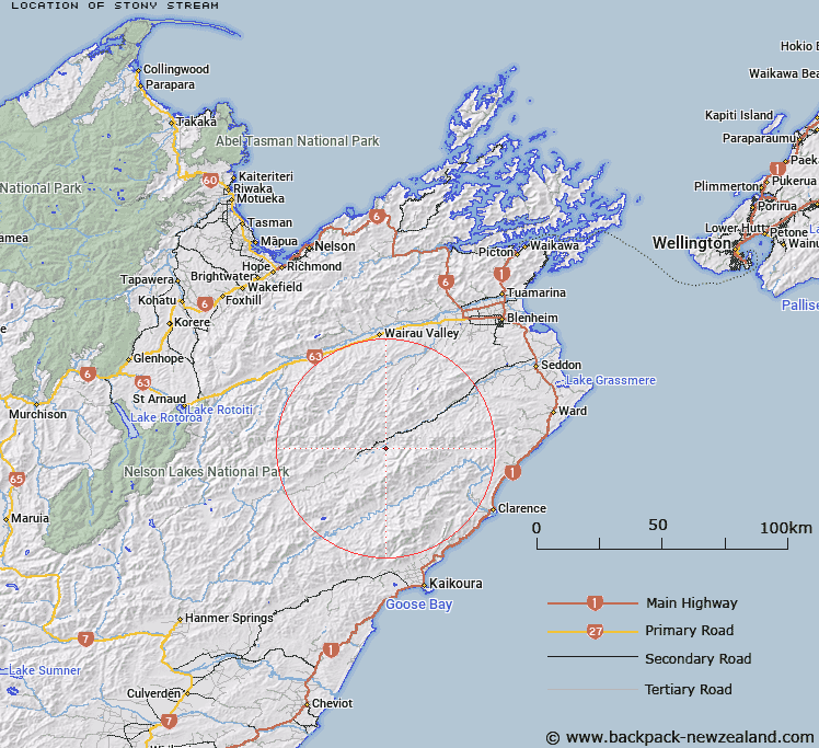
Map showing location of Stony Stream
LINZ description: Right bank tributary of Awatere River rising 2km North-west of Mount Gladstone (Geodetic Code 1172), flowing North-westward, and joining Awatere River 2km North-east of Mount Upcot (Geodetic Code B7LD), and 2km downstream of Winterton River. Block IV Upcot Survey District and Block V Tapuaenuku Survey District.
Latitude: -41.947125
Longitude: 173.551552
Northing: 5355947.3
Easting: 1645716.1
Land District: Marlborough
Feat Type: Stream
Latitude: -41.947125
Longitude: 173.551552
Northing: 5355947.3
Easting: 1645716.1
Land District: Marlborough
Feat Type: Stream

Scroll down to see a more detailed road map and below that a topographical map showing the location of Stony Stream. The road map has been supplied by openstreetmap and the topographical map of Stony Stream has been supplied by Land Information New Zealand (LINZ).
Yes you can use the top static map for you school/university project or personal website with a link back. Contact me for any commercial use.
[ A ] [ B ] [ C ] [ D ] [ E ] [ F ] [ G ] [ H ] [ I ] [ J ] [ K ] [ L ] [ M ] [ N ] [ O ] [ P ] [ Q ] [ R ] [ S ] [ T ] [ U ] [ V ] [ W ] [ X ] [ Y ] [ Z ]