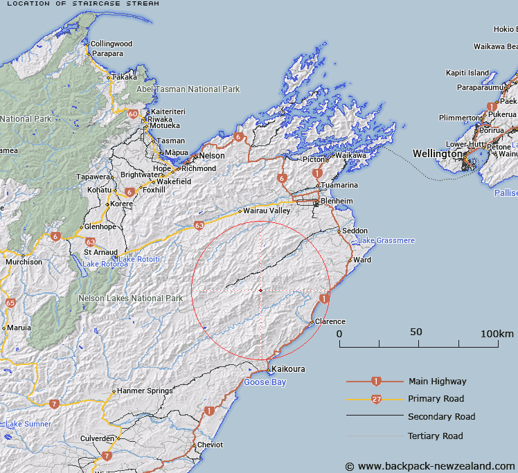
Map showing location of Staircase Stream
LINZ description: Right bank tributary of Hodder River, rising on the western slopes of Tapuae-o-Uenuku in the Inland Kaikoura Range, flowing north-westward and joining Hodder River 3.3km due West of Crows Nest. Block VI, Tapuaenuku Survey District.
Latitude: -41.985849
Longitude: 173.642167
Northing: 5351595.6
Easting: 1653194.6
Land District: Marlborough
Feat Type: Stream
Latitude: -41.985849
Longitude: 173.642167
Northing: 5351595.6
Easting: 1653194.6
Land District: Marlborough
Feat Type: Stream

Scroll down to see a more detailed road map and below that a topographical map showing the location of Staircase Stream. The road map has been supplied by openstreetmap and the topographical map of Staircase Stream has been supplied by Land Information New Zealand (LINZ).
Yes you can use the top static map for you school/university project or personal website with a link back. Contact me for any commercial use.
[ A ] [ B ] [ C ] [ D ] [ E ] [ F ] [ G ] [ H ] [ I ] [ J ] [ K ] [ L ] [ M ] [ N ] [ O ] [ P ] [ Q ] [ R ] [ S ] [ T ] [ U ] [ V ] [ W ] [ X ] [ Y ] [ Z ]