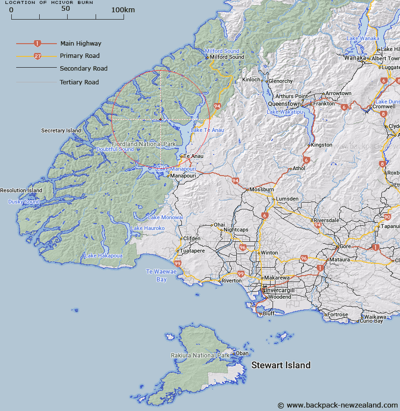
Map showing location of McIvor Burn


LINZ description: Stream in the valley up to and beyond Lake McIvor, from north side of Southwest Arm of Middle Fiord, Lake Te Anau. Arran Survey District.
Latitude: -45.134393
Longitude: 167.556216
Northing: 4987685.7
Easting: 1171953.6
Land District: Southland
Feat Type: Stream


Scroll down to see a more detailed road map and below that a topographical map showing the location of McIvor Burn. The road map has been supplied by openstreetmap and the topographical map of McIvor Burn has been supplied by Land Information New Zealand (LINZ).

Yes you can use the top static map for you school/university project or personal website with a link back. Contact me for any commercial use.

McIvor Burn Map New Zealand


New Zealand places in our database
[ A ] [ B ] [ C ] [ D ] [ E ] [ F ] [ G ] [ H ] [ I ] [ J ] [ K ] [ L ] [ M ] [ N ] [ O ] [ P ] [ Q ] [ R ] [ S ] [ T ] [ U ] [ V ] [ W ] [ X ] [ Y ] [ Z ]


Closest 20 Streams to McIvor Burn

Snag Burn ( 6.36km )   Doon River ( 6.97km )   Pisgah Creek ( 7.17km )   Woodrow Burn ( 7.32km )   Loch Burn ( 7.82km )   Junction Burn ( 8.29km )   Barrier Stream ( 9.51km )   Campbell Creek ( 9.55km )   Jennings Burn ( 10.14km )   Austral Creek ( 10.45km )   Mid Burn ( 10.94km )   Stillwater River ( 11.65km )   Plateau Creek ( 11.99km )   Canyon Creek ( 12.08km )   Rugged Burn ( 13.18km )   West Burn ( 13.18km )   Lugar Burn ( 13.6km )   Wapiti River ( 13.76km )   Rugged Burn ( 13.76km )   Ettrick Burn ( 14.21km )   Lyall Burn ( 14.23km )   Large Burn ( 14.3km )   Chester Burn ( 14.3km )   Tertiary Creek ( 14.43km )   Wisely Burn ( 15.13km )   Inaccessible Creek ( 15.34km )   Lake Creek ( 15.47km )   McKenzie Burn ( 17.94km )   Point Burn ( 18.06km )   Henderson Burn ( 18.41km )   Katherine Creek ( 18.46km )   Mystery Burn ( 18.52km )   Ethne Stream ( 18.58km )   Nita Creek ( 18.85km )   Takahe Stream ( 18.89km )   William Burn ( 18.92km )   Waterfall Creek ( 18.99km )   Forster Burn ( 19.02km )   Edith River ( 19.28km )   Overlander Stream ( 19.32km )