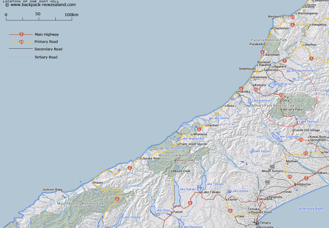
Map showing location of One Shot Hill


LINZ description: Hill (1214m), 3km North-east of Mount Pfeifer [Trig. XB (Geodetic Code B2H6)]. Block VII, Otira Survey District.
Latitude: -42.789299
Longitude: 171.646603
Northing: 5261694.6
Easting: 1489309.8
Land District: Westland
Feat Type: Hill


Scroll down to see a more detailed road map and below that a topographical map showing the location of One Shot Hill. The road map has been supplied by openstreetmap and the topographical map of One Shot Hill has been supplied by Land Information New Zealand (LINZ).

Yes you can use the top static map for you school/university project or personal website with a link back. Contact me for any commercial use.

One Shot Hill Map New Zealand


New Zealand places in our database
[ A ] [ B ] [ C ] [ D ] [ E ] [ F ] [ G ] [ H ] [ I ] [ J ] [ K ] [ L ] [ M ] [ N ] [ O ] [ P ] [ Q ] [ R ] [ S ] [ T ] [ U ] [ V ] [ W ] [ X ] [ Y ] [ Z ]


Closest 20 Hills to One Shot Hill

Mount Pfeifer ( 3.02km )   Mount Tarapuhi ( 3.41km )   Goat Hill ( 6km )   Mount Russel ( 6.6km )   Kellys Hill ( 6.89km )   Mount Howe ( 6.91km )   Mount Alexander ( 7.96km )   Mount Franklin ( 9.04km )   Mount McRae ( 9.28km )   Mount Koeti ( 10.49km )   Mount Barron ( 11.03km )   Hills Peak ( 11.81km )   Rangi Taipo ( 12.31km )   Mount Hunt ( 12.58km )   Scarface Mountain ( 12.64km )   Phipps Peak ( 12.68km )   Falling Mountain ( 12.7km )   Mount Oates ( 12.95km )   Mount Temple ( 13.2km )   Rugged Peaks ( 13.6km )   Warnocks Knob ( 13.94km )   Blimit ( 14.37km )   Mount Philistine ( 14.63km )   Smooth Peak ( 14.64km )   Mount Wilkinson ( 14.65km )   Mount Cassidy ( 15km )   Valiant Mountain ( 15.33km )   Mount Scott ( 15.63km )   Mount Wilson ( 16.08km )   Mount Aicken ( 16.27km )   Mount Morrison ( 16.35km )   Mount Dixon ( 16.48km )   Anderson Peak ( 16.5km )   Green Hill ( 16.56km )   Mount O'Shanessy ( 16.64km )   Mount Armstrong ( 16.96km )   Mount Bowers ( 17.31km )   Mount Rolleston ( 17.46km )   Mount O'Malley ( 18.02km )   Mount Byrne ( 18.08km )