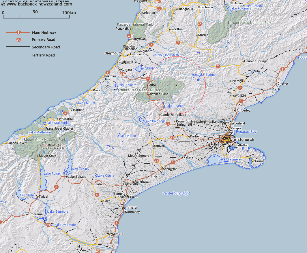
Map showing location of Montgomery Stream


LINZ description: Right bank tributary of Cox River, rising 1.8km South-east of Mount Row, flowing South-eastward and joining Cox River 4.1km upstream of Row Stream. Block XII, Minchin Survey District.
Latitude: -42.828858
Longitude: 171.949998
Northing: 5257655.4
Easting: 1514178.6
Land District: Canterbury
Feat Type: Stream


Scroll down to see a more detailed road map and below that a topographical map showing the location of Montgomery Stream. The road map has been supplied by openstreetmap and the topographical map of Montgomery Stream has been supplied by Land Information New Zealand (LINZ).

Yes you can use the top static map for you school/university project or personal website with a link back. Contact me for any commercial use.

Montgomery Stream Map New Zealand


New Zealand places in our database
[ A ] [ B ] [ C ] [ D ] [ E ] [ F ] [ G ] [ H ] [ I ] [ J ] [ K ] [ L ] [ M ] [ N ] [ O ] [ P ] [ Q ] [ R ] [ S ] [ T ] [ U ] [ V ] [ W ] [ X ] [ Y ] [ Z ]


Closest 20 Streams to Montgomery Stream

Cox River ( 1.1km )   Cochran Stream ( 3.25km )   Row Stream ( 3.25km )   Ellis Stream ( 4.76km )   Ranger Stream ( 5.08km )   Cherrywood Creek ( 5.67km )   Bull Creek ( 5.89km )   Fenwick Stream ( 6.7km )   Thompson Stream ( 6.78km )   Beckett Stream ( 7.08km )   Morrison Stream ( 7.15km )   Candlestick Stream ( 7.84km )   Penny Stream ( 8.44km )   Hurunui River South Branch ( 8.45km )   Cleland Stream ( 10.71km )   Minchin Stream ( 11.58km )   Casey Stream ( 11.67km )   Blockhouse Stream ( 11.68km )   Linwood Creek ( 12.03km )   North Esk River ( 12.08km )   Cameron Stream ( 12.31km )   Locke Creek ( 12.36km )   Fooks Stream ( 12.36km )   Wilkinson Creek ( 12.56km )   Poulter River East Branch ( 12.69km )   Townsend Creek ( 12.84km )   Crossley Stream ( 12.92km )   Surprise Stream ( 13.45km )   P?kio Stream ( 13.59km )   Nigger Stream ( 13.59km )   Lochinvar Stream ( 13.65km )   Hurunui River ( 13.7km )   Trinity Stream ( 14.05km )   Kennedy Stream ( 14.07km )   Poulter River ( 14.32km )   Whio Stream ( 14.34km )   Pampas Stream ( 14.6km )   Trudge Stream ( 14.6km )   Turnbull Stream ( 14.7km )   Lucy Stream ( 15.04km )