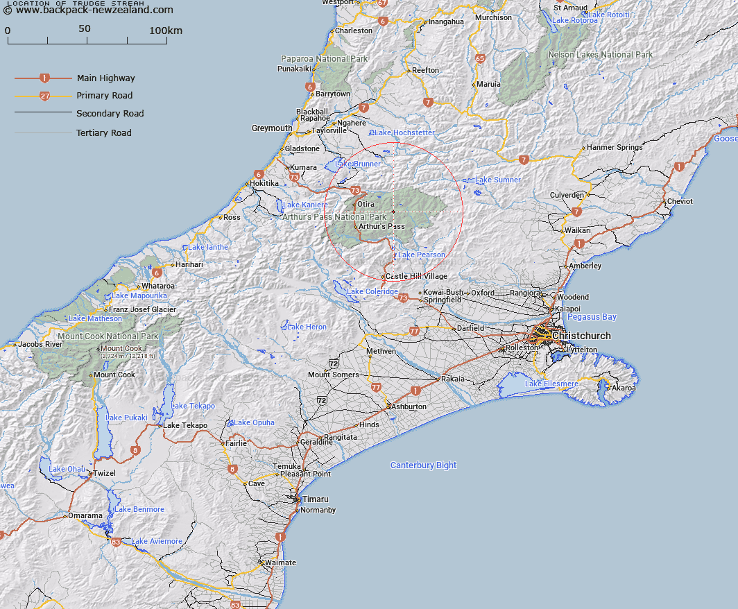
Map showing location of Trudge Stream


LINZ description: Right bank tributary of the Poulter River rising North-east of Trudge Col, flowing North-eastward and joining the Poulter River 3km East by South-east of Worsley Pass. Block I, Hawdon Survey District.
Latitude: -42.866548
Longitude: 171.778467
Northing: 5253281
Easting: 1500219
Land District: Canterbury
Feat Type: Stream


Scroll down to see a more detailed road map and below that a topographical map showing the location of Trudge Stream. The road map has been supplied by openstreetmap and the topographical map of Trudge Stream has been supplied by Land Information New Zealand (LINZ).

Yes you can use the top static map for you school/university project or personal website with a link back. Contact me for any commercial use.

Trudge Stream Map New Zealand


New Zealand places in our database
[ A ] [ B ] [ C ] [ D ] [ E ] [ F ] [ G ] [ H ] [ I ] [ J ] [ K ] [ L ] [ M ] [ N ] [ O ] [ P ] [ Q ] [ R ] [ S ] [ T ] [ U ] [ V ] [ W ] [ X ] [ Y ] [ Z ]


Closest 20 Streams to Trudge Stream

Enchanted Stream ( 1.68km )   Chasm Stream ( 3.24km )   Minchin Stream ( 4.25km )   Tawhana Stream ( 5.11km )   Poulter River ( 5.12km )   Otehake River East Branch ( 5.29km )   East Hawdon Stream ( 5.79km )   Twin Fall Stream ( 5.93km )   Koropuku Creek ( 6.31km )   Surprise Stream ( 6.43km )   Casey Stream ( 6.53km )   Linwood Creek ( 6.75km )   Pampas Stream ( 6.79km )   Otehake River West Branch ( 6.91km )   Discovery Stream ( 7km )   Trinity Stream ( 7.79km )   Hawdon River ( 8.08km )   Whaiti Stream ( 8.48km )   Fenwick Stream ( 8.58km )   Morrison Stream ( 8.75km )   Ranger Stream ( 9.52km )   Otehake River ( 10.02km )   Penny Stream ( 10.73km )   Townsend Creek ( 11.08km )   Thompson Stream ( 11.37km )   Cherrywood Creek ( 11.74km )   Spray Creek ( 11.8km )   Mount Brown Creek ( 12.19km )   Row Stream ( 12.21km )   Sudden Valley Stream ( 12.4km )   Andrews Stream ( 12.42km )   Riversdale Stream ( 12.46km )   Good Luck Creek ( 12.49km )   Wilkinson Creek ( 12.7km )   Midday Creek ( 12.73km )   Cleland Stream ( 12.75km )   Jacksons Creek ( 12.79km )   Lake Creek ( 12.81km )   Pfeifer Creek ( 12.82km )   Deception River ( 12.94km )