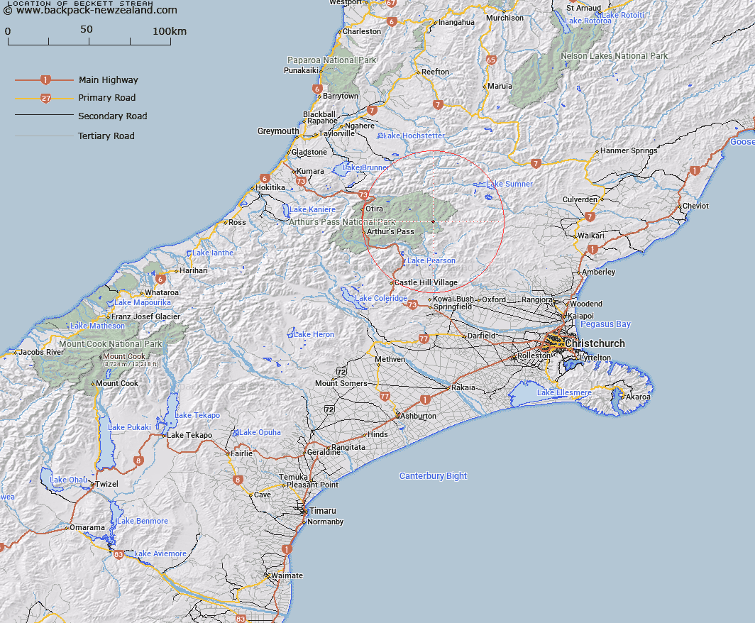
Map showing location of Beckett Stream


LINZ description: Right bank tributary of Cox River rising in the Poulter Range 1.8km North-east of Forest Peak, flowing South-eastward and joining Cox River 400m upstreamt of Bull Creek. Block IV, Hawdon Survey District.
Latitude: -42.892404
Longitude: 171.944284
Northing: 5250592.9
Easting: 1513800
Land District: Canterbury
Feat Type: Stream


Scroll down to see a more detailed road map and below that a topographical map showing the location of Beckett Stream. The road map has been supplied by openstreetmap and the topographical map of Beckett Stream has been supplied by Land Information New Zealand (LINZ).

Yes you can use the top static map for you school/university project or personal website with a link back. Contact me for any commercial use.

Beckett Stream Map New Zealand


New Zealand places in our database
[ A ] [ B ] [ C ] [ D ] [ E ] [ F ] [ G ] [ H ] [ I ] [ J ] [ K ] [ L ] [ M ] [ N ] [ O ] [ P ] [ Q ] [ R ] [ S ] [ T ] [ U ] [ V ] [ W ] [ X ] [ Y ] [ Z ]


Closest 20 Streams to Beckett Stream

Cleland Stream ( 4.02km )   Row Stream ( 4.63km )   Cochran Stream ( 5.63km )   Poulter River East Branch ( 5.79km )   Fenwick Stream ( 5.83km )   Cox River ( 6.1km )   Montgomery Stream ( 7.08km )   Ranger Stream ( 7.19km )   Turnbull Stream ( 7.66km )   Casey Stream ( 8.17km )   Lochinvar Stream ( 8.32km )   Nigger Stream ( 8.52km )   P?kio Stream ( 8.52km )   Mount Brown Creek ( 8.85km )   Trinity Stream ( 9.53km )   Surprise Stream ( 9.63km )   Camp Stream ( 10.19km )   Bull Creek ( 10.38km )   Candlestick Stream ( 10.47km )   Morrison Stream ( 10.53km )   Pampas Stream ( 10.54km )   Cherrywood Creek ( 11.01km )   Flora Stream ( 11.08km )   Fooks Stream ( 11.13km )   Ellis Stream ( 11.61km )   Boundary Stream ( 11.79km )   Thompson Stream ( 11.92km )   Pete Stream ( 12.67km )   Baldy Stream ( 12.77km )   Minchin Stream ( 12.79km )   Penny Stream ( 13.19km )   Trudge Stream ( 13.81km )   East Hawdon Stream ( 14.11km )   Ant Stream ( 14.17km )   Linwood Creek ( 14.66km )   Anna Stream ( 14.86km )   Andrews Stream ( 15.19km )   Esk River ( 15.21km )   Crossley Stream ( 15.29km )   Enchanted Stream ( 15.29km )