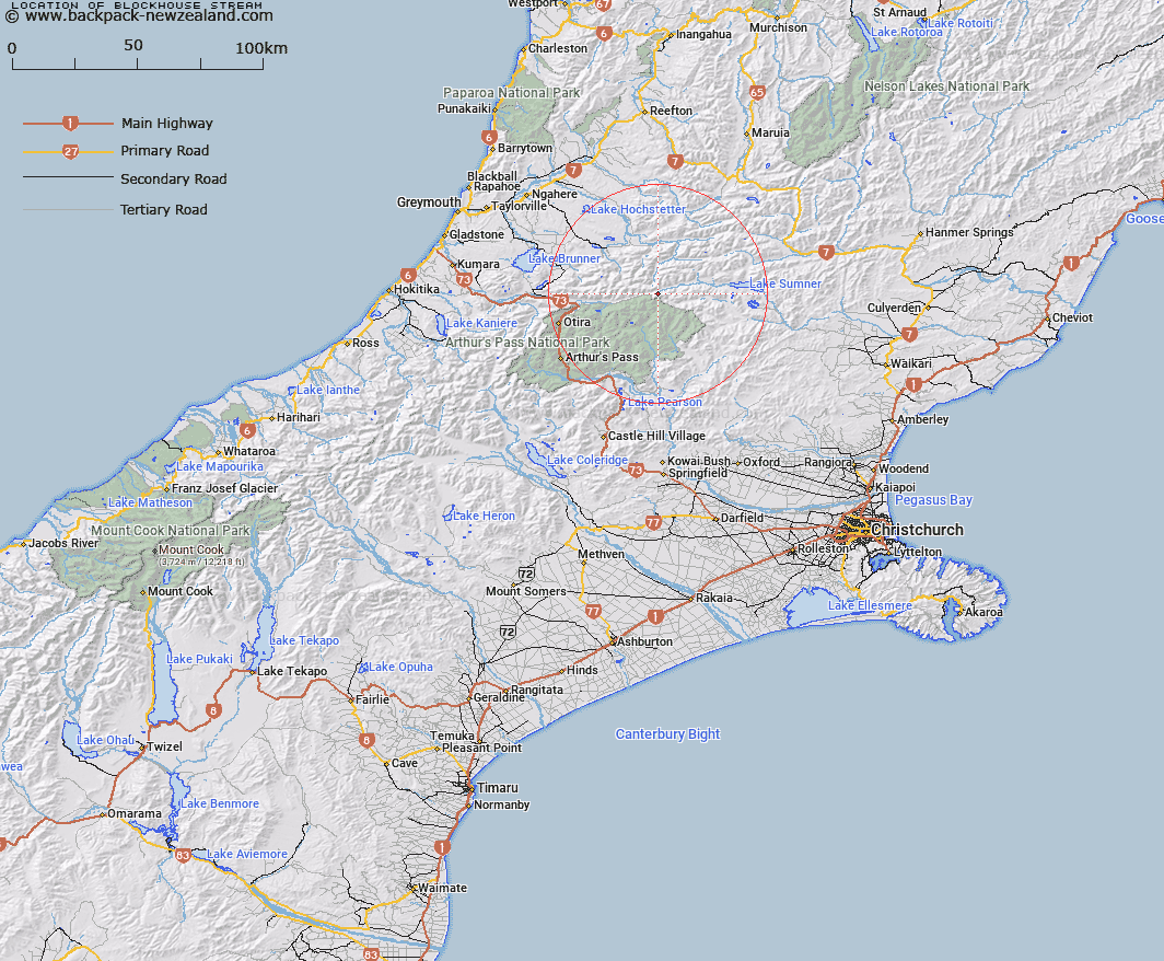
Map showing location of Blockhouse Stream


LINZ description: Short stream in Lake Sumner State Forest, near the Main Divide. Tributary of Hurunui River rising at junction of Dampier and Crawford Ranges.
Latitude: -42.728521
Longitude: 171.907566
Northing: 5268753.2
Easting: 1510566.1
Land District: Canterbury
Feat Type: Stream


Scroll down to see a more detailed road map and below that a topographical map showing the location of Blockhouse Stream. The road map has been supplied by openstreetmap and the topographical map of Blockhouse Stream has been supplied by Land Information New Zealand (LINZ).

Yes you can use the top static map for you school/university project or personal website with a link back. Contact me for any commercial use.

Blockhouse Stream Map New Zealand


New Zealand places in our database
[ A ] [ B ] [ C ] [ D ] [ E ] [ F ] [ G ] [ H ] [ I ] [ J ] [ K ] [ L ] [ M ] [ N ] [ O ] [ P ] [ Q ] [ R ] [ S ] [ T ] [ U ] [ V ] [ W ] [ X ] [ Y ] [ Z ]


Closest 20 Streams to Blockhouse Stream

Hurunui River South Branch ( 3.81km )   Whio Stream ( 4.1km )   Blue Stream ( 4.17km )   Trent River ( 4.52km )   Hurunui River ( 5.37km )   Cameron Stream ( 5.59km )   Camp Stream ( 5.6km )   Locke Creek ( 6.65km )   Dixon Creek ( 6.65km )   Graf Creek ( 6.73km )   Wilkinson Creek ( 7.21km )   Thompson Stream ( 7.87km )   Penny Stream ( 7.95km )   Cherrywood Creek ( 8.19km )   Yeo Creek ( 8.37km )   Waterfall Stream ( 8.88km )   Ellis Stream ( 8.92km )   Townsend Creek ( 8.92km )   Joseph Creek ( 9.52km )   Landslip Stream ( 9.7km )   Waikiti River ( 10.25km )   Morrison Stream ( 10.64km )   Michael Creek ( 11.13km )   Montgomery Stream ( 11.68km )   Linwood Creek ( 12.25km )   Ranger Stream ( 12.63km )   Cox River ( 12.78km )   Dido Creek ( 12.86km )   Mackenzie Stream ( 13.26km )   Bull Creek ( 13.54km )   Logjam Creek ( 13.55km )   Row Stream ( 13.9km )   Tutaekuri River ( 14.04km )   Jacksons Creek ( 14.33km )   Minchin Stream ( 14.37km )   Taverners Creek ( 14.55km )   Cochran Stream ( 14.59km )   Poulter River ( 14.91km )   Fenwick Stream ( 15.25km )   Candlestick Stream ( 16.33km )