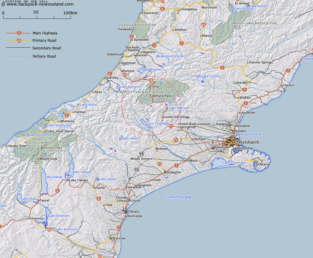
Map showing location of Mid Hill


LINZ description: Hill on the Black Range at head of Long Creek tributaries, between Bruce Saddle and Lagoon Saddle
Latitude: -43.06807
Longitude: 171.570257
Northing: 5230634.2
Easting: 1483591.9
Land District: Canterbury
Feat Type: Hill


Scroll down to see a more detailed road map and below that a topographical map showing the location of Mid Hill. The road map has been supplied by openstreetmap and the topographical map of Mid Hill has been supplied by Land Information New Zealand (LINZ).

Yes you can use the top static map for you school/university project or personal website with a link back. Contact me for any commercial use.

Mid Hill Map New Zealand


New Zealand places in our database
[ A ] [ B ] [ C ] [ D ] [ E ] [ F ] [ G ] [ H ] [ I ] [ J ] [ K ] [ L ] [ M ] [ N ] [ O ] [ P ] [ Q ] [ R ] [ S ] [ T ] [ U ] [ V ] [ W ] [ X ] [ Y ] [ Z ]


Closest 20 Hills to Mid Hill

Packard Peak ( 3.16km )   Mount Bruce ( 3.97km )   Thesis Peak ( 6.12km )   Stag Hill ( 7.57km )   Nervous Knob ( 10.71km )   Hamilton Peak ( 10.85km )   Mount Misery ( 11.12km )   Mottram Peaks ( 11.16km )   Fitzwilliam Mountain ( 11.45km )   Mount Bealey ( 11.48km )   Mount Wall ( 11.65km )   Mount Gizeh ( 11.81km )   Damfool ( 11.83km )   Mount Cockayne ( 11.83km )   Cow Peak ( 11.91km )   Dome ( 12.63km )   Mount Williams ( 12.76km )   Mount Cheeseman ( 12.79km )   Mount Horrible ( 12.8km )   Lyell Peak ( 12.88km )   Mount Stewart ( 12.98km )   Baldy Hill ( 13.11km )   Mount Olympus ( 13.23km )   Mount O'Malley ( 13.62km )   Mount Manson ( 13.72km )   Romulus ( 13.8km )   Mount Greenlaw ( 13.81km )   Avoca Mountain ( 14.03km )   Avalanche Peak ( 14.18km )   Mount Izard ( 14.41km )   Mount Speight ( 14.42km )   Corner Knob ( 14.71km )   Mount Foweraker ( 14.74km )   Gargarus ( 14.77km )   Mount Guinevere ( 14.91km )   Bridge Hill ( 15.2km )   Helicopter Hill ( 15.2km )   Mount Harper ( 15.34km )   Remus ( 15.38km )   Mount Aicken ( 15.38km )