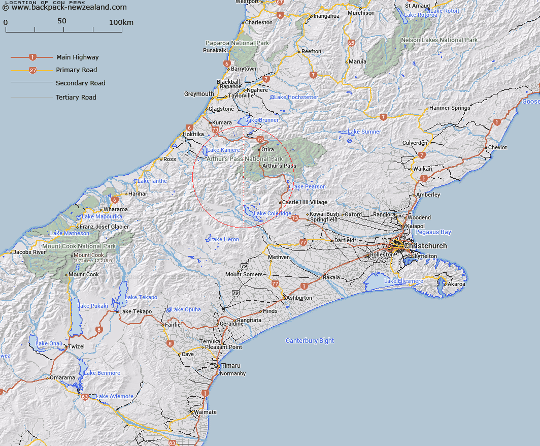
Map showing location of Cow Peak


LINZ description: Small summit west of Gizeh Col
Latitude: -43.02252
Longitude: 171.43764
Northing: 5235500
Easting: 1472700
Land District: Canterbury
Feat Type: Hill


Scroll down to see a more detailed road map and below that a topographical map showing the location of Cow Peak. The road map has been supplied by openstreetmap and the topographical map of Cow Peak has been supplied by Land Information New Zealand (LINZ).

Yes you can use the top static map for you school/university project or personal website with a link back. Contact me for any commercial use.

Cow Peak Map New Zealand


New Zealand places in our database
[ A ] [ B ] [ C ] [ D ] [ E ] [ F ] [ G ] [ H ] [ I ] [ J ] [ K ] [ L ] [ M ] [ N ] [ O ] [ P ] [ Q ] [ R ] [ S ] [ T ] [ U ] [ V ] [ W ] [ X ] [ Y ] [ Z ]


Closest 20 Hills to Cow Peak

Damfool ( 0.51km )   Mount Gizeh ( 0.94km )   Mount Greenlaw ( 2.14km )   Mottram Peaks ( 2.31km )   Mount Speight ( 2.75km )   Avoca Mountain ( 3.02km )   Mount Harper ( 3.97km )   Mount Murchison ( 5.35km )   Mount Wakeman ( 5.43km )   Mount Davie ( 7.26km )   Mount Stewart ( 7.55km )   Mount Isobel ( 8.4km )   Mount Guinevere ( 9.27km )   Sebastopol ( 9.36km )   Mount Campbell ( 9.66km )   Mount Marion ( 9.67km )   Mount Marianne ( 9.67km )   Fang Hill ( 9.74km )   Mount Rosamond ( 9.87km )   Mount Bealey ( 10.72km )   Mount Pope ( 10.73km )   Lyell Peak ( 10.81km )   Thesis Peak ( 10.93km )   Mount Harman/Kaniere ( 11.54km )   Mount Harman ( 11.54km )   Lilian Mount ( 11.84km )   Five Jagged Peaks ( 11.88km )   Packard Peak ( 11.9km )   Mid Hill ( 11.91km )   Avalanche Peak ( 11.91km )   Mount Ethel ( 11.94km )   Mount Lancelot ( 12.09km )   Mount Walter ( 12.14km )   Carrington Peak ( 12.41km )   Mount Axis ( 12.52km )   Mount Findlay ( 12.61km )   Taipos Breast ( 12.7km )   Twin Peaks ( 12.75km )   Mount Beals ( 13km )   Mount Scott ( 13.17km )