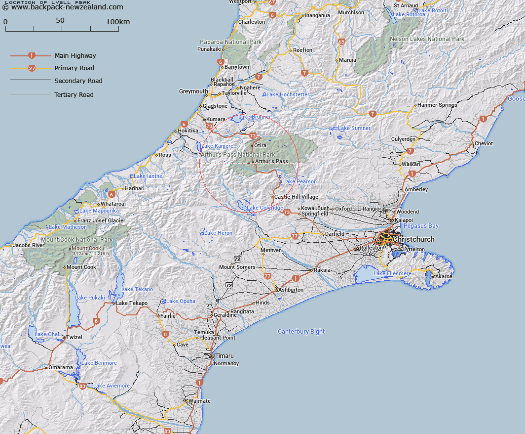
Map showing location of Lyell Peak


LINZ description: South of Avalanche Peak
Latitude: -42.955355
Longitude: 171.533739
Northing: 5243100
Easting: 1480400
Land District: Canterbury
Feat Type: Hill


Scroll down to see a more detailed road map and below that a topographical map showing the location of Lyell Peak. The road map has been supplied by openstreetmap and the topographical map of Lyell Peak has been supplied by Land Information New Zealand (LINZ).

Yes you can use the top static map for you school/university project or personal website with a link back. Contact me for any commercial use.

Lyell Peak Map New Zealand


New Zealand places in our database
[ A ] [ B ] [ C ] [ D ] [ E ] [ F ] [ G ] [ H ] [ I ] [ J ] [ K ] [ L ] [ M ] [ N ] [ O ] [ P ] [ Q ] [ R ] [ S ] [ T ] [ U ] [ V ] [ W ] [ X ] [ Y ] [ Z ]


Closest 20 Hills to Lyell Peak

Avalanche Peak ( 1.38km )   Mount Bealey ( 1.54km )   Mount Stewart ( 3.72km )   Mount Guinevere ( 3.76km )   Mount Lancelot ( 4.28km )   Mount O'Malley ( 5.05km )   Mount Rolleston ( 5.17km )   Mount Aicken ( 5.92km )   Mount Cassidy ( 5.99km )   Blimit ( 6.7km )   Carrington Peak ( 6.96km )   Warnocks Knob ( 7.02km )   Mount Williams ( 7.61km )   Mount Philistine ( 7.65km )   Mount Temple ( 7.67km )   Mount Armstrong ( 7.79km )   Phipps Peak ( 8.1km )   Mount Campbell ( 8.18km )   Mottram Peaks ( 8.51km )   Anderson Peak ( 8.71km )   Hills Peak ( 8.89km )   Taipos Breast ( 9.71km )   Damfool ( 10.31km )   Mount Harper ( 10.6km )   Mount Isobel ( 10.74km )   Cow Peak ( 10.81km )   Mount Bowers ( 10.82km )   Mount Speight ( 10.89km )   Dome ( 10.91km )   Mount Oates ( 11.07km )   Mount Davie ( 11.49km )   Mount Gizeh ( 11.64km )   Mount Rosamond ( 11.78km )   Mount Wilson ( 12.09km )   Mount Marion ( 12.41km )   Mount Marianne ( 12.41km )   Mount Scott ( 12.49km )   Mount Greenlaw ( 12.53km )   Mount Bruce ( 12.81km )   Mid Hill ( 12.88km )