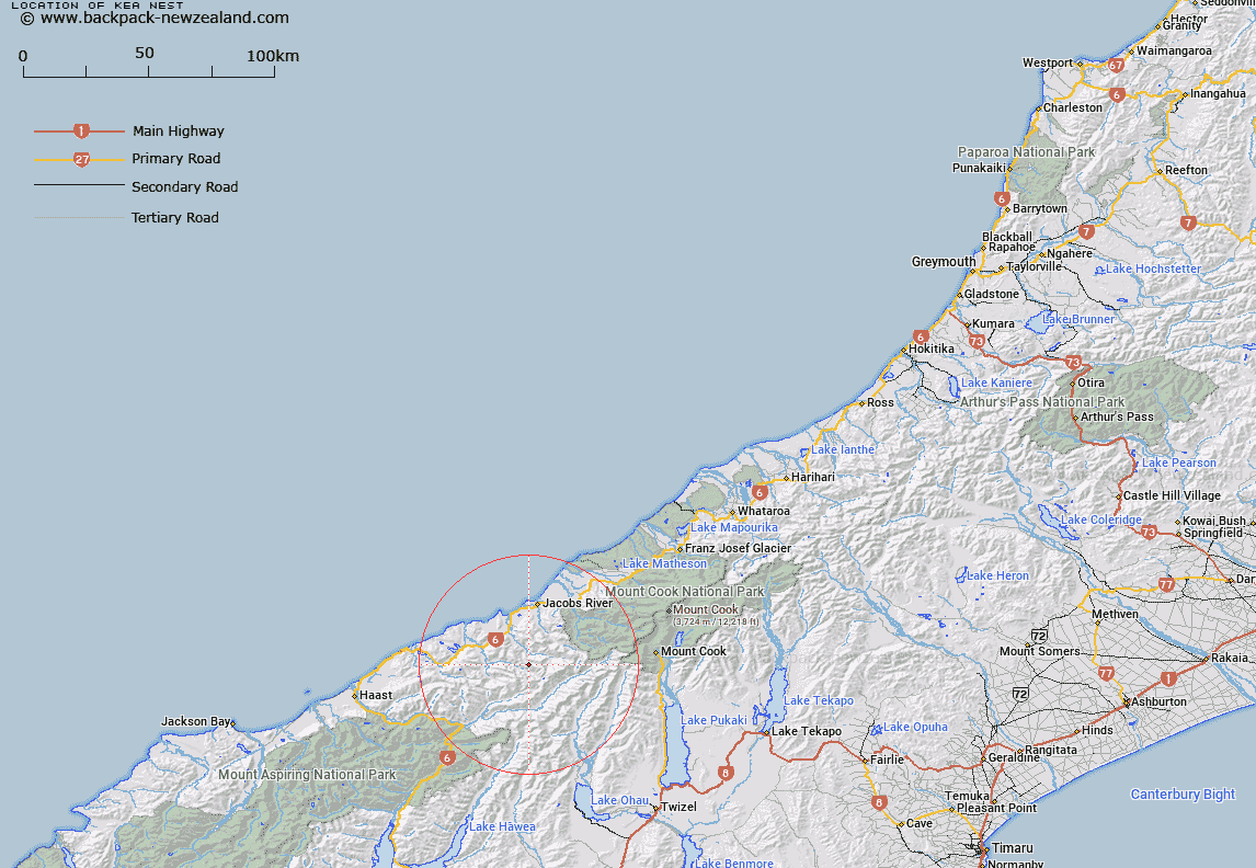
Map showing location of Kea Nest


LINZ description: A semi-circular shaped feature above the Otoko River, on the slopes of the Strachan Range, 1km South of Mount Northcroft. Block XV Mount Douglas Survey District.
Latitude: -43.77537
Longitude: 169.649498
Northing: 5147618.2
Easting: 1330358.3
Land District: Westland
Feat Type: Basin


Scroll down to see a more detailed road map and below that a topographical map showing the location of Kea Nest. The road map has been supplied by openstreetmap and the topographical map of Kea Nest has been supplied by Land Information New Zealand (LINZ).

Yes you can use the top static map for you school/university project or personal website with a link back. Contact me for any commercial use.

Kea Nest Map New Zealand


New Zealand places in our database
[ A ] [ B ] [ C ] [ D ] [ E ] [ F ] [ G ] [ H ] [ I ] [ J ] [ K ] [ L ] [ M ] [ N ] [ O ] [ P ] [ Q ] [ R ] [ S ] [ T ] [ U ] [ V ] [ W ] [ X ] [ Y ] [ Z ]


Closest 20 Basins to Kea Nest

Waterfall Basin ( 33.65km )   Lagoon Basin ( 34.95km )   Eggeling Basin ( 56.34km )   Young Basin ( 61.92km )   Gillespie Basin ( 63.15km )   Stony Basin ( 76.63km )   Tindill Basin ( 78.03km )   Devils Hollow ( 80.6km )   Mackay Basin ( 82.96km )   Odyssey Basin ( 87.42km )   Iliad Basin ( 87.89km )   Balaclava Basins ( 89.61km )   Camp Basin ( 92.22km )   Scour Basin ( 94.84km )   Sandys Basin ( 97.49km )   MacPherson Cirque ( 105.03km )   Kea Basin ( 134.46km )   Aurum Basin ( 139.03km )   Boundary Basin ( 142.38km )   Mistake Basin ( 142.74km )   Cattle Basin ( 145.13km )   Cookies Basins ( 146.18km )   Pulpit Basin ( 148.24km )   Sonora Basin ( 148.53km )   Moa Basins ( 150.32km )   Scott Basin ( 155.54km )   Dead Horse Basin ( 156.4km )   Glacier Basin ( 157.8km )   Luna Basin ( 158.03km )   Boulder Basin ( 159.1km )   Back Basin ( 161.02km )   Sleepy Hollow ( 161.23km )   McNulty Basin ( 169.29km )   Freshwater Basin ( 169.8km )   Stirling Basin ( 169.91km )   Makere Basin ( 169.91km )   Deepwater Basin ( 170.71km )   Dale Basin ( 171.55km )   Te Motu tu o te ruru ( 172.35km )   Entrance Basin ( 172.6km )