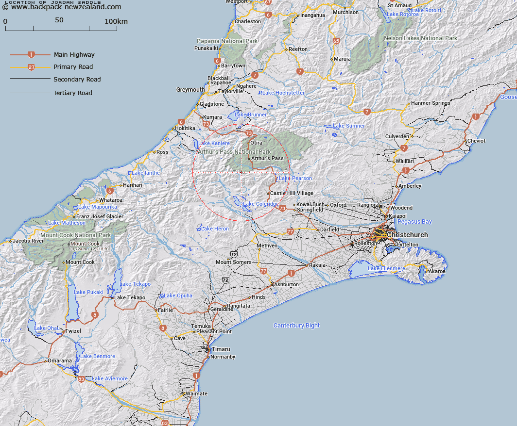
Map showing location of Jordan Saddle


LINZ description: On the Black Range near the boundary between Harper and Wilberforce Survey Districts, between Jordan Stream and Gallilee Creek.
Latitude: -43.050974
Longitude: 171.504941
Northing: 5232440.1
Easting: 1478240.1
Land District: Canterbury
Feat Type: Pass


Scroll down to see a more detailed road map and below that a topographical map showing the location of Jordan Saddle. The road map has been supplied by openstreetmap and the topographical map of Jordan Saddle has been supplied by Land Information New Zealand (LINZ).

Yes you can use the top static map for you school/university project or personal website with a link back. Contact me for any commercial use.

Jordan Saddle Map New Zealand


New Zealand places in our database
[ A ] [ B ] [ C ] [ D ] [ E ] [ F ] [ G ] [ H ] [ I ] [ J ] [ K ] [ L ] [ M ] [ N ] [ O ] [ P ] [ Q ] [ R ] [ S ] [ T ] [ U ] [ V ] [ W ] [ X ] [ Y ] [ Z ]


Closest 20 Passs to Jordan Saddle

Jordan Saddle ( 0km )   Bruce Saddle ( 3.94km )   Sphinx Saddle ( 4.03km )   Echo Col ( 5.69km )   Fools Col ( 6.69km )   Gizeh Col ( 6.76km )   Lagoon Saddle ( 7.18km )   Greenlaw Col ( 8.14km )   Half Moon Saddle ( 9.24km )   White Col ( 10.54km )   Kahutea Col ( 11.49km )   Gargarus Saddle ( 13.67km )   Harman Pass ( 14.2km )   Whitehorn Pass ( 14.37km )   Cass Saddle ( 15.35km )   Williams Saddle ( 16.06km )   Campbell Pass ( 16.12km )   Arthur's Pass ( 16.58km )   Popes Pass ( 16.67km )   Waimakariri Col ( 16.87km )   Browning Pass/Noti Raureka ( 17.25km )   Browning Pass ( 17.25km )   Temple Col ( 17.54km )   Bijleveld Col ( 17.96km )   Grave Col ( 18.6km )   Farquharson Saddle ( 19.03km )   Hall Col ( 19.11km )   Goat Pass ( 19.19km )   Griffiths Saddle ( 19.9km )   Goldney Saddle ( 19.93km )   Moa Saddle ( 20.56km )   Clarkes Pass ( 21.26km )   Hokitika Saddle ( 21.9km )   Amber Col ( 21.93km )   Taruahuna Pass ( 22.42km )   Hura Saddle ( 22.53km )   Mungo Pass ( 22.94km )   Tarn Col ( 23.07km )   Styx Saddle ( 23.12km )   Lathrop Saddle ( 23.88km )