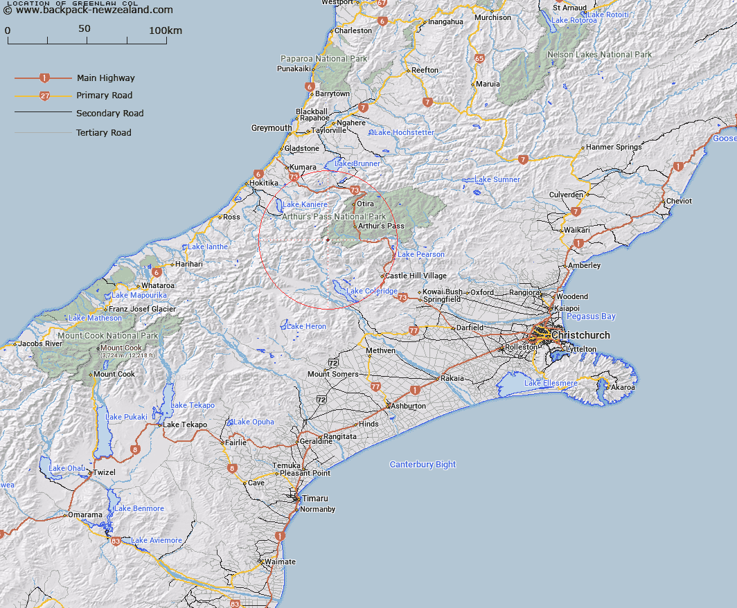
Map showing location of Greenlaw Col


LINZ description: Between the high and low peaks of Greenlaw
Latitude: -43.017716
Longitude: 171.415672
Northing: 5236000
Easting: 1470900
Land District: Canterbury
Feat Type: Pass


Scroll down to see a more detailed road map and below that a topographical map showing the location of Greenlaw Col. The road map has been supplied by openstreetmap and the topographical map of Greenlaw Col has been supplied by Land Information New Zealand (LINZ).

Yes you can use the top static map for you school/university project or personal website with a link back. Contact me for any commercial use.

Greenlaw Col Map New Zealand


New Zealand places in our database
[ A ] [ B ] [ C ] [ D ] [ E ] [ F ] [ G ] [ H ] [ I ] [ J ] [ K ] [ L ] [ M ] [ N ] [ O ] [ P ] [ Q ] [ R ] [ S ] [ T ] [ U ] [ V ] [ W ] [ X ] [ Y ] [ Z ]


Closest 20 Passs to Greenlaw Col

Gizeh Col ( 1.41km )   Fools Col ( 1.6km )   Echo Col ( 2.5km )   White Col ( 2.84km )   Kahutea Col ( 3.35km )   Sphinx Saddle ( 4.16km )   Half Moon Saddle ( 6.89km )   Whitehorn Pass ( 7.68km )   Jordan Saddle ( 8.14km )   Harman Pass ( 8.8km )   Browning Pass/Noti Raureka ( 9.53km )   Browning Pass ( 9.53km )   Popes Pass ( 9.55km )   Grave Col ( 10.48km )   Farquharson Saddle ( 10.9km )   Hall Col ( 11.01km )   Bruce Saddle ( 11.78km )   Griffiths Saddle ( 11.79km )   Campbell Pass ( 12.39km )   Clarkes Pass ( 13.34km )   Hokitika Saddle ( 14.26km )   Bijleveld Col ( 14.52km )   Lagoon Saddle ( 14.87km )   Waimakariri Col ( 14.96km )   Moa Saddle ( 15.02km )   Styx Saddle ( 15.9km )   Lathrop Saddle ( 16.01km )   Mungo Pass ( 16.09km )   Arthur's Pass ( 16.97km )   Hura Saddle ( 17.23km )   Gargarus Saddle ( 18.12km )   Temple Col ( 18.81km )   Unknown Col ( 18.99km )   Mistake Col ( 19.09km )   Zit Saddle ( 19.69km )   Toaroha Saddle ( 19.98km )   Williams Saddle ( 20.07km )   Newton Saddle ( 20.28km )   Excellent Saddle ( 21.05km )   Goat Pass ( 21.33km )