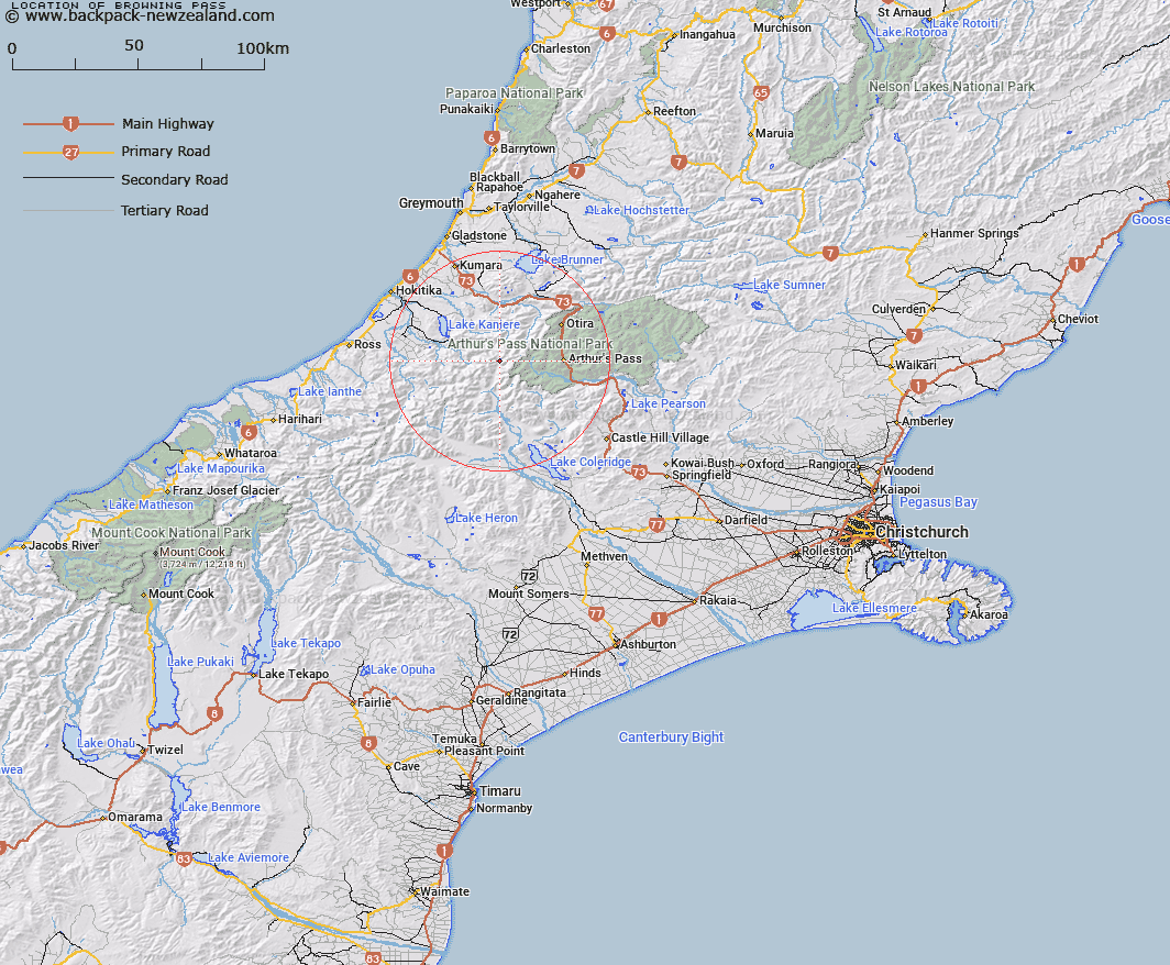
Map showing location of Browning Pass


LINZ description: Feature shown on: NZMS260-K33 749050; NZTopo50-BV19 651433;
Latitude: -42.949814
Longitude: 171.344105
Northing: 5243428.1
Easting: 1464919.5
Land District: Canterbury, Westland
Feat Type: Pass


Scroll down to see a more detailed road map and below that a topographical map showing the location of Browning Pass. The road map has been supplied by openstreetmap and the topographical map of Browning Pass has been supplied by Land Information New Zealand (LINZ).

Yes you can use the top static map for you school/university project or personal website with a link back. Contact me for any commercial use.

Browning Pass Map New Zealand


New Zealand places in our database
[ A ] [ B ] [ C ] [ D ] [ E ] [ F ] [ G ] [ H ] [ I ] [ J ] [ K ] [ L ] [ M ] [ N ] [ O ] [ P ] [ Q ] [ R ] [ S ] [ T ] [ U ] [ V ] [ W ] [ X ] [ Y ] [ Z ]


Closest 20 Passs to Browning Pass

Popes Pass ( 2.34km )   Hall Col ( 3.36km )   Grave Col ( 3.38km )   Farquharson Saddle ( 3.83km )   Whitehorn Pass ( 4.04km )   Griffiths Saddle ( 6.26km )   Harman Pass ( 6.44km )   Styx Saddle ( 6.61km )   Lathrop Saddle ( 6.65km )   Kahutea Col ( 6.75km )   White Col ( 6.78km )   Clarkes Pass ( 8.97km )   Greenlaw Col ( 9.53km )   Campbell Pass ( 10.14km )   Fools Col ( 10.68km )   Hura Saddle ( 10.7km )   Gizeh Col ( 10.9km )   Hokitika Saddle ( 11.08km )   Bijleveld Col ( 11.72km )   Echo Col ( 11.95km )   Sphinx Saddle ( 13.27km )   Newton Saddle ( 13.53km )   Zit Saddle ( 13.79km )   Waimakariri Col ( 14.09km )   Dunn Saddle ( 14.57km )   Mungo Pass ( 14.87km )   Half Moon Saddle ( 14.93km )   Toaroha Saddle ( 16.46km )   Scottys Saddle ( 16.72km )   Moa Saddle ( 16.79km )   Jordan Saddle ( 17.25km )   Kawhaka Pass ( 18.12km )   Arthur's Pass ( 18.17km )   Mistake Col ( 18.23km )   Unknown Col ( 18.72km )   Hunt Saddle ( 19.22km )   One Tree Saddle ( 19.81km )   Temple Col ( 20.52km )   Steadman Saddle ( 20.81km )   Bruce Saddle ( 21.1km )