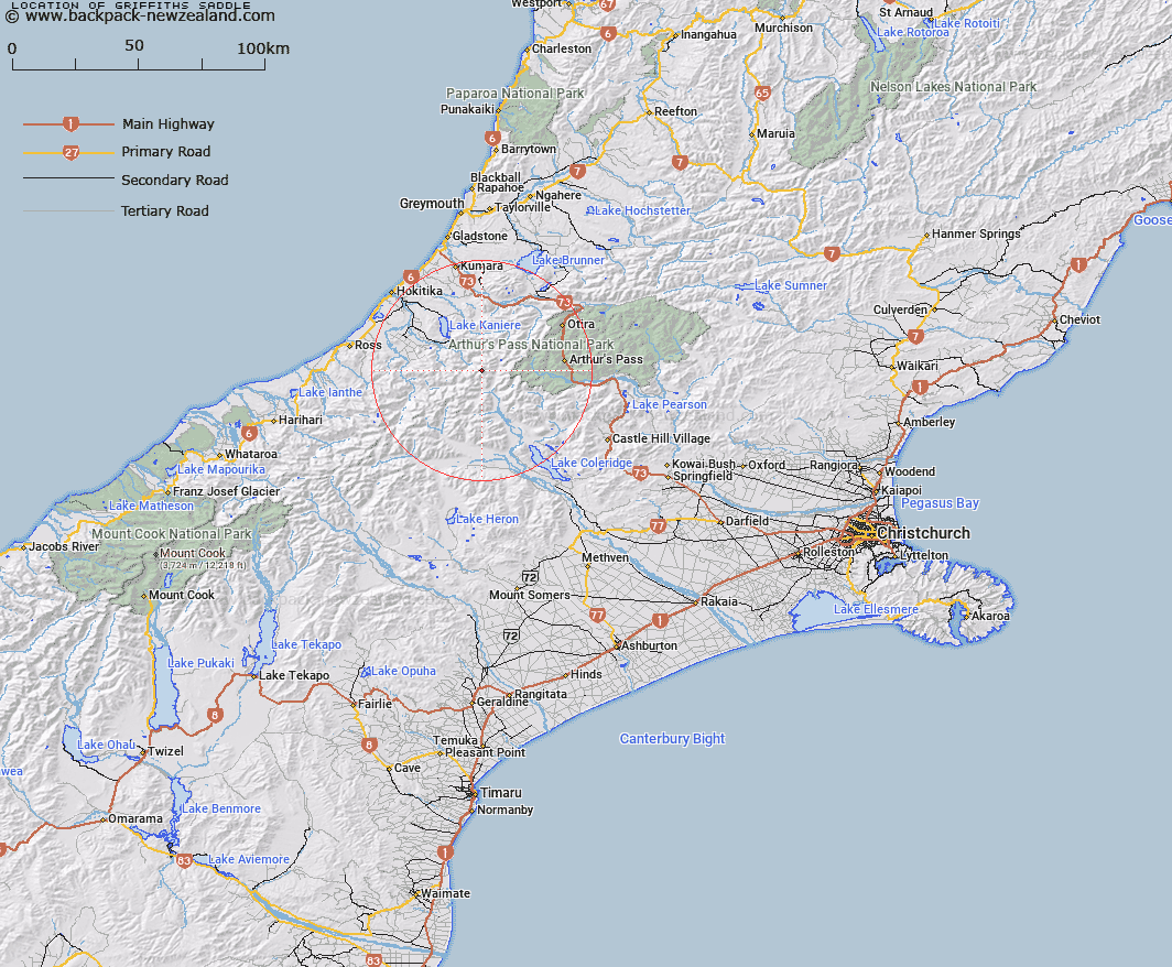
Map showing location of Griffiths Saddle


LINZ description: Low saddle at the head of Griffiths Glacier, between Mount Griffiths and Mount Camsell. Davie Survey District.
Latitude: -42.980735
Longitude: 171.279748
Northing: 5239888.9
Easting: 1459739.8
Land District: Canterbury
Feat Type: Pass


Scroll down to see a more detailed road map and below that a topographical map showing the location of Griffiths Saddle. The road map has been supplied by openstreetmap and the topographical map of Griffiths Saddle has been supplied by Land Information New Zealand (LINZ).

Yes you can use the top static map for you school/university project or personal website with a link back. Contact me for any commercial use.

Griffiths Saddle Map New Zealand


New Zealand places in our database
[ A ] [ B ] [ C ] [ D ] [ E ] [ F ] [ G ] [ H ] [ I ] [ J ] [ K ] [ L ] [ M ] [ N ] [ O ] [ P ] [ Q ] [ R ] [ S ] [ T ] [ U ] [ V ] [ W ] [ X ] [ Y ] [ Z ]


Closest 20 Passs to Griffiths Saddle

Farquharson Saddle ( 2.49km )   Clarkes Pass ( 2.72km )   Grave Col ( 2.89km )   Hall Col ( 3.08km )   Hokitika Saddle ( 4.92km )   Browning Pass/Noti Raureka ( 6.26km )   Browning Pass ( 6.26km )   Lathrop Saddle ( 7.29km )   Zit Saddle ( 8.17km )   Kahutea Col ( 8.46km )   Popes Pass ( 8.6km )   Mungo Pass ( 8.98km )   Whitehorn Pass ( 9.87km )   White Col ( 9.95km )   Toaroha Saddle ( 10.21km )   Styx Saddle ( 10.3km )   Greenlaw Col ( 11.79km )   Moa Saddle ( 11.92km )   Mistake Col ( 12.24km )   Harman Pass ( 12.46km )   Unknown Col ( 12.88km )   Gizeh Col ( 13.15km )   Fools Col ( 13.34km )   Echo Col ( 14.22km )   Half Moon Saddle ( 14.47km )   Steadman Saddle ( 14.55km )   One Tree Saddle ( 15.93km )   Sphinx Saddle ( 15.95km )   Campbell Pass ( 16.37km )   Hura Saddle ( 16.39km )   Meta Saddle ( 17.71km )   Bijleveld Col ( 17.98km )   Mathias Pass ( 18.55km )   Frew Saddle ( 18.72km )   Newton Saddle ( 18.93km )   Excellent Saddle ( 19.59km )   Dunn Saddle ( 19.87km )   Jordan Saddle ( 19.9km )   Waimakariri Col ( 20.29km )   Kawhaka Pass ( 20.7km )