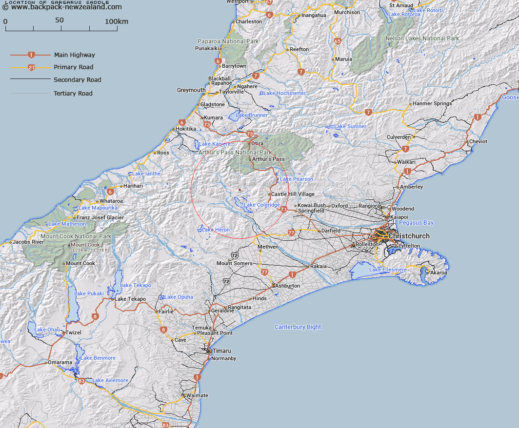
Map showing location of Gargarus Saddle


LINZ description: Between Mount Gargarus and the Birdwood Range leading to Glenthorne from the Avoca.
Latitude: -43.172898
Longitude: 171.48365
Northing: 5218868.9
Easting: 1476751
Land District: Canterbury
Feat Type: Pass


Scroll down to see a more detailed road map and below that a topographical map showing the location of Gargarus Saddle. The road map has been supplied by openstreetmap and the topographical map of Gargarus Saddle has been supplied by Land Information New Zealand (LINZ).

Yes you can use the top static map for you school/university project or personal website with a link back. Contact me for any commercial use.

Gargarus Saddle Map New Zealand


New Zealand places in our database
[ A ] [ B ] [ C ] [ D ] [ E ] [ F ] [ G ] [ H ] [ I ] [ J ] [ K ] [ L ] [ M ] [ N ] [ O ] [ P ] [ Q ] [ R ] [ S ] [ T ] [ U ] [ V ] [ W ] [ X ] [ Y ] [ Z ]


Closest 20 Passs to Gargarus Saddle

Bruce Saddle ( 11.11km )   Half Moon Saddle ( 12.63km )   Jordan Saddle ( 13.67km )   Sphinx Saddle ( 15.84km )   Echo Col ( 16.17km )   Lagoon Saddle ( 16.34km )   Gizeh Col ( 16.98km )   Cass Saddle ( 17.46km )   Fools Col ( 17.57km )   Coleridge Pass ( 18.02km )   Greenlaw Col ( 18.12km )   Excellent Saddle ( 20.22km )   Kahutea Col ( 20.52km )   Moa Saddle ( 20.77km )   White Col ( 20.93km )   Turtons Saddle ( 22.8km )   Porters Pass ( 24.75km )   Mungo Pass ( 25.23km )   Unknown Col ( 25.37km )   The Gap ( 25.74km )   Whitehorn Pass ( 25.78km )   Mistake Col ( 26.28km )   Hokitika Saddle ( 26.49km )   Harman Pass ( 26.52km )   Griffiths Saddle ( 27.03km )   Clarkes Pass ( 27.05km )   Grave Col ( 27.11km )   Long Hill Saddle ( 27.13km )   Browning Pass/Noti Raureka ( 27.27km )   Browning Pass ( 27.27km )   Farquharson Saddle ( 27.37km )   Goldney Saddle ( 27.58km )   Popes Pass ( 27.64km )   Hall Col ( 27.72km )   Williams Saddle ( 28.19km )   St Bernard Saddle ( 28.4km )   Redcliff Saddle ( 28.44km )   Campbell Pass ( 29.27km )   Poachers Pass ( 30.14km )   Arthur's Pass ( 30.17km )