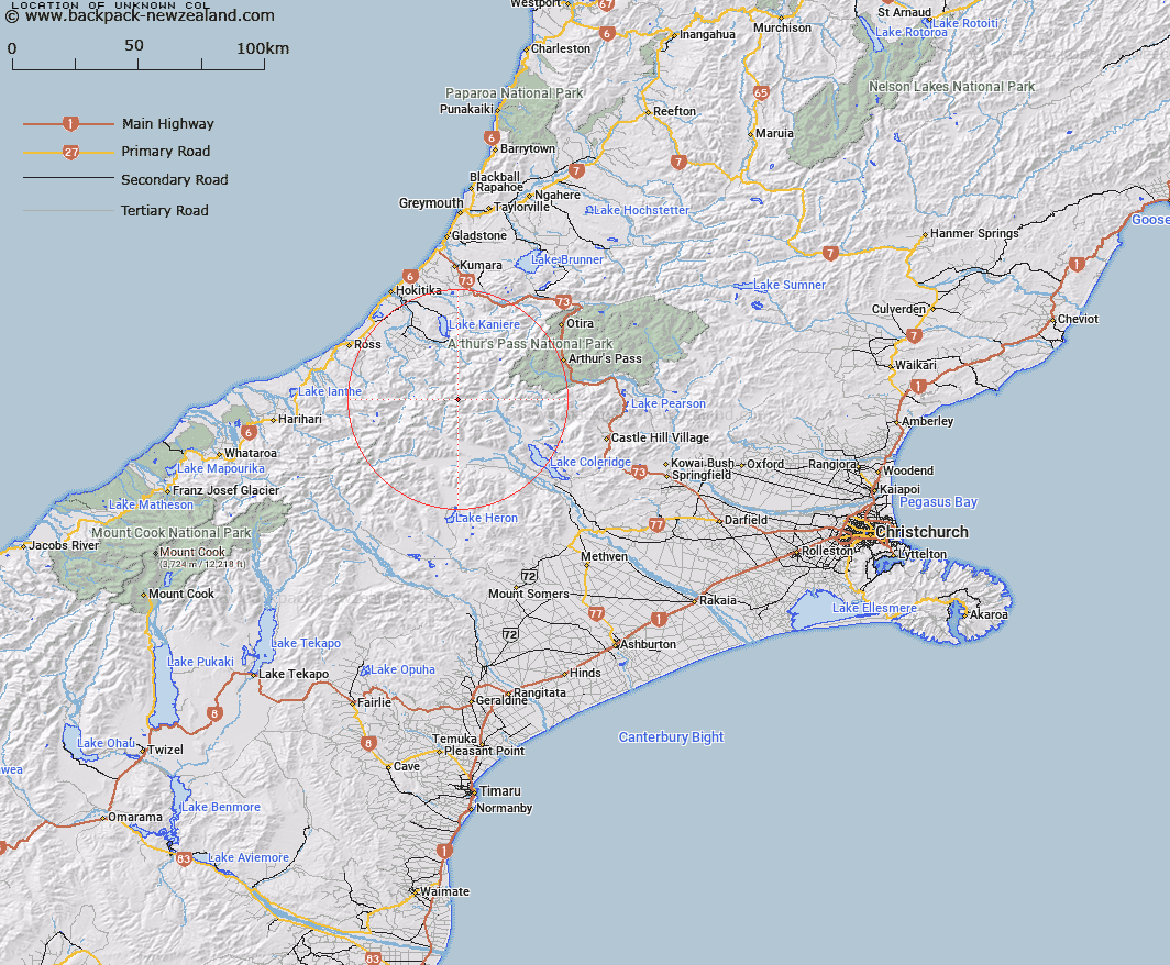
Map showing location of Unknown Col


LINZ description: Col at the head of the North Mathias River in the Rolleston Range.
Latitude: -43.079986
Longitude: 171.198116
Northing: 5228727.2
Easting: 1453320.4
Land District: Canterbury
Feat Type: Pass


Scroll down to see a more detailed road map and below that a topographical map showing the location of Unknown Col. The road map has been supplied by openstreetmap and the topographical map of Unknown Col has been supplied by Land Information New Zealand (LINZ).

Yes you can use the top static map for you school/university project or personal website with a link back. Contact me for any commercial use.

Unknown Col Map New Zealand


New Zealand places in our database
[ A ] [ B ] [ C ] [ D ] [ E ] [ F ] [ G ] [ H ] [ I ] [ J ] [ K ] [ L ] [ M ] [ N ] [ O ] [ P ] [ Q ] [ R ] [ S ] [ T ] [ U ] [ V ] [ W ] [ X ] [ Y ] [ Z ]


Closest 20 Passs to Unknown Col

Mistake Col ( 1.19km )   Mungo Pass ( 3.9km )   Moa Saddle ( 4.81km )   Steadman Saddle ( 5.56km )   Toaroha Saddle ( 6.48km )   Mathias Pass ( 7.03km )   Hokitika Saddle ( 8.07km )   Excellent Saddle ( 8.77km )   Frew Saddle ( 8.78km )   Clarkes Pass ( 10.34km )   Kea Pass ( 10.39km )   Meta Saddle ( 10.42km )   Zit Saddle ( 11.33km )   Griffiths Saddle ( 12.88km )   Farquharson Saddle ( 15.28km )   Grave Col ( 15.58km )   Hall Col ( 15.91km )   Half Moon Saddle ( 16.2km )   Kahutea Col ( 16.84km )   Browning Pass/Noti Raureka ( 18.72km )   Browning Pass ( 18.72km )   Greenlaw Col ( 18.99km )   White Col ( 18.99km )   Lathrop Saddle ( 19.43km )   Poachers Pass ( 19.57km )   Gizeh Col ( 19.75km )   One Tree Saddle ( 19.75km )   Fools Col ( 20.43km )   Echo Col ( 20.44km )   Dickson Pass ( 20.58km )   Popes Pass ( 20.94km )   Whitehorn Pass ( 21.45km )   Murray Saddle ( 21.73km )   Sphinx Saddle ( 22.23km )   Seddon Col ( 22.74km )   Styx Saddle ( 23.05km )   Douglas Saddle ( 23.4km )   Harman Pass ( 24.03km )   Whitcombe Pass ( 24.36km )   McKenzie Col ( 25.04km )