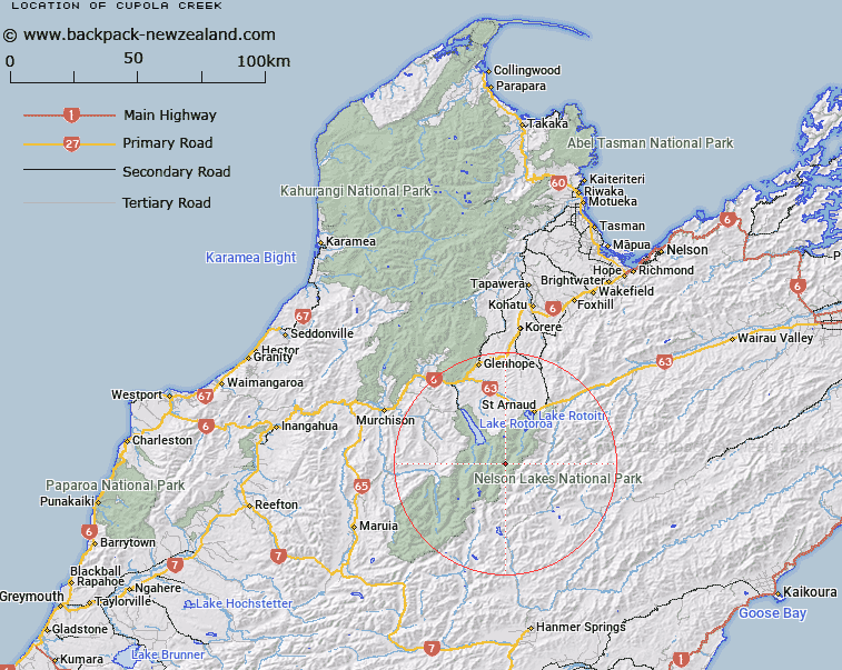
Map showing location of Cupola Creek


LINZ description: Stream in Nelson Lakes National Park. Drains area between Mounts Cupola and Hopeless and flows into Travers River. Arnaud Survey District.
Latitude: -41.976293
Longitude: 172.742559
Northing: 5352823.9
Easting: 1578671.4
Land District: Nelson
Feat Type: Stream


Scroll down to see a more detailed road map and below that a topographical map showing the location of Cupola Creek. The road map has been supplied by openstreetmap and the topographical map of Cupola Creek has been supplied by Land Information New Zealand (LINZ).

Yes you can use the top static map for you school/university project or personal website with a link back. Contact me for any commercial use.

Cupola Creek Map New Zealand


New Zealand places in our database
[ A ] [ B ] [ C ] [ D ] [ E ] [ F ] [ G ] [ H ] [ I ] [ J ] [ K ] [ L ] [ M ] [ N ] [ O ] [ P ] [ Q ] [ R ] [ S ] [ T ] [ U ] [ V ] [ W ] [ X ] [ Y ] [ Z ]


Closest 20 Streams to Cupola Creek

Summit Creek ( 1.93km )   Sabine River ( 4.42km )   Travers River ( 4.5km )   East Branch Sabine River ( 5.84km )   Hopeless Creek ( 6.29km )   Cattle Stream ( 7.89km )   Open Stream ( 8.48km )   Hukere Stream ( 8.76km )   Begley Creek ( 8.81km )   Arnst Gully ( 8.87km )   Arnst River ( 8.87km )   Hamilton River ( 8.88km )   Rainbow River ( 9.87km )   Connors Creek ( 9.92km )   Ngaro Stream ( 10.23km )   Shift Creek ( 10.23km )   West Branch Sabine River ( 10.38km )   Shroders Creek ( 10.89km )   Bull Creek ( 11.7km )   Clearwater Stream ( 11.94km )   D'Urville River ( 12.23km )   St Ronans Stream ( 12.61km )   Coldwater Stream ( 12.72km )   Cedric Stream ( 12.77km )   Chandler Stream ( 13.03km )   Tanekaha Creek ( 13.6km )   Canon Creek ( 13.69km )   Six Mile Creek ( 14.03km )   M?ori Stream ( 14.27km )   Paske Creek ( 14.93km )   Tier Stream ( 15.22km )   Lees Creek ( 15.44km )   Whisky Creek ( 16.12km )   Mole Stream ( 16.58km )   Hodgson Stream ( 16.85km )   Watson Creek ( 17.14km )   Hellfire Stream ( 17.31km )   Te Horowai / Speargrass Creek ( 17.41km )   Speargrass Creek ( 17.41km )   Johansen Stream ( 17.48km )