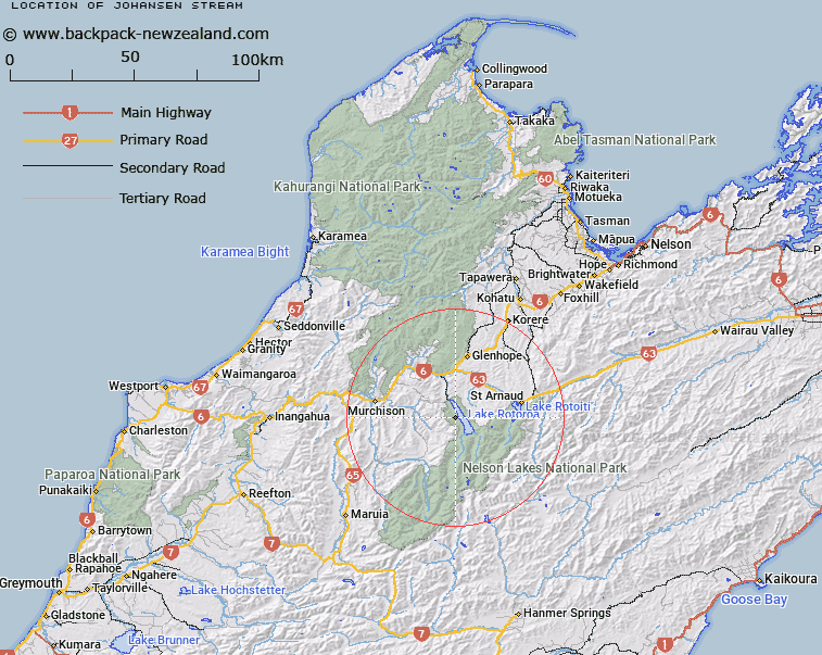
Map showing location of Johansen Stream


LINZ description: Western tributary of Lake Rotoroa, rising 5.1km North North-west of Mount Hutton [Trig. O (Geodetic Code A5AJ)], flowing generally eastward, and flowing into Lake Rotoroa 2.1km North-east of Trig. I Playfair (Geodetic Code A5AK). Block VI Rotoroa Survey District.
Latitude: -41.855238
Longitude: 172.6077
Northing: 5366222
Easting: 1567437.1
Land District: Nelson
Feat Type: Stream


Scroll down to see a more detailed road map and below that a topographical map showing the location of Johansen Stream. The road map has been supplied by openstreetmap and the topographical map of Johansen Stream has been supplied by Land Information New Zealand (LINZ).

Yes you can use the top static map for you school/university project or personal website with a link back. Contact me for any commercial use.

Johansen Stream Map New Zealand


New Zealand places in our database
[ A ] [ B ] [ C ] [ D ] [ E ] [ F ] [ G ] [ H ] [ I ] [ J ] [ K ] [ L ] [ M ] [ N ] [ O ] [ P ] [ Q ] [ R ] [ S ] [ T ] [ U ] [ V ] [ W ] [ X ] [ Y ] [ Z ]


Closest 20 Streams to Johansen Stream

Boulder Stream ( 1.94km )   M?ori Stream ( 3.22km )   Atkinson Stream ( 5.45km )   McCaa Stream ( 6.01km )   Gibbs Creek ( 7.19km )   Swampy Creek ( 7.31km )   Tier Stream ( 7.48km )   Tiraumea River ( 8.01km )   Adit Stream ( 8.11km )   Cedric Stream ( 8.14km )   Te Wiriki Stream ( 8.17km )   Hodgson Stream ( 8.31km )   Coleman Creek ( 9.02km )   Cattle Stream ( 9.66km )   Bull Creek ( 9.67km )   Snows Stream ( 9.68km )   Louis Creek ( 9.76km )   Open Stream ( 9.83km )   Te Kauparenui / Gowan River ( 10.25km )   Gowan River ( 10.25km )   Three Peaks Stream ( 11.45km )   Tutaki River East Branch ( 11.46km )   Howard River ( 11.57km )   Hinemoat? / Howard River ( 11.57km )   Long Gully Stream ( 11.58km )   Te Peita Stream ( 11.59km )   Te Patiti Stream ( 11.67km )   Tutaki River ( 11.83km )   Porika Stream ( 11.95km )   Marr Creek ( 11.98km )   New Creek ( 12.42km )   Maud Creek ( 12.56km )   Maggie Creek ( 13.05km )   Hopeless Creek ( 13.37km )   Skeat Creek ( 13.97km )   Pigeon Creek ( 13.97km )   Sabine River ( 14.16km )   Mole Stream ( 14.94km )   Hukere Stream ( 14.96km )   Tutaki River West Branch ( 15.17km )