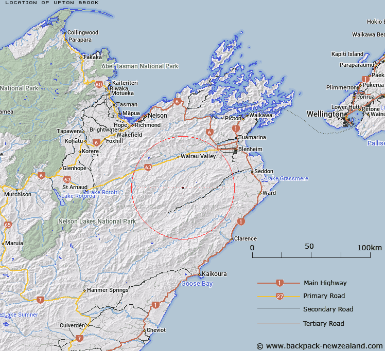
Map showing location of Upton Brook


LINZ description: Right bank tributary of Avon River rising approximately 300m East of Mount Delight, flowing northward and joining Avon River 1.4km upstream of Malvern Hills homestead. Block X, Hodder Survey District.
Latitude: -41.786252
Longitude: 173.564864
Northing: 5373801.3
Easting: 1646937
Land District: Marlborough
Feat Type: Stream


Scroll down to see a more detailed road map and below that a topographical map showing the location of Upton Brook. The road map has been supplied by openstreetmap and the topographical map of Upton Brook has been supplied by Land Information New Zealand (LINZ).

Yes you can use the top static map for you school/university project or personal website with a link back. Contact me for any commercial use.

Upton Brook Map New Zealand


New Zealand places in our database
[ A ] [ B ] [ C ] [ D ] [ E ] [ F ] [ G ] [ H ] [ I ] [ J ] [ K ] [ L ] [ M ] [ N ] [ O ] [ P ] [ Q ] [ R ] [ S ] [ T ] [ U ] [ V ] [ W ] [ X ] [ Y ] [ Z ]


Closest 20 Streams to Upton Brook

Five Mile Stream ( 1.98km )   Non Upton Brook ( 2.1km )   White Pine Stream ( 2.4km )   Cow Stream ( 4.91km )   Teme River ( 5.66km )   Junction Creek ( 6.09km )   Tea Tree Stream ( 6.21km )   Tin Hut Stream ( 7.22km )   Kellings Creek ( 8.42km )   Grey River ( 9.66km )   Back Range Stream ( 9.68km )   Manuka Stream ( 9.76km )   Dore Stream ( 10.02km )   Burnt Country Creek ( 10.06km )   Musgrave Brook ( 10.11km )   Waihopai River ( 10.72km )   House Creek ( 10.73km )   Ribble Stream ( 10.98km )   Cannister Creek ( 11.05km )   Burr Stream ( 11.77km )   Clyde Stream ( 11.81km )   Bolton Stream ( 11.93km )   Penk River ( 12.18km )   Netherwood Stream ( 12.33km )   Whare Stream ( 12.62km )   Wadsworth Stream ( 13.07km )   Dinner Stream ( 13.28km )   Pass Brook ( 13.29km )   Tummil River ( 13.37km )   Limestone Stream ( 13.85km )   Shingley Stream ( 14.23km )   Station Stream ( 14.41km )   Cam River ( 14.44km )   Sweets Stream ( 14.46km )   Ring Creek ( 14.73km )   Bouldery Stream ( 14.88km )   Upcot Stream ( 14.89km )   Byron Stream ( 15.14km )   Isis Stream ( 15.19km )   Bill Massey Creek ( 15.31km )