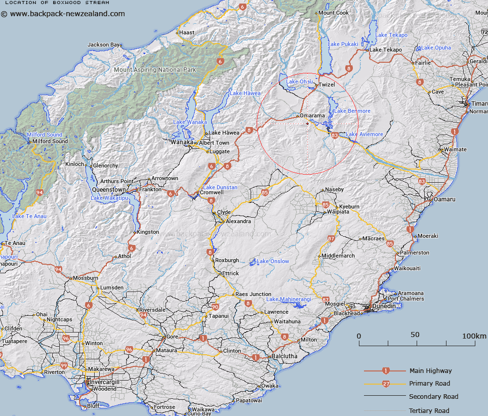
Map showing location of Boxwood Stream


LINZ description: Stream flowing from St Cuthbert Range into Glen Creek, 9km south of Omarama.
Latitude: -44.541449
Longitude: 170.031846
Northing: 5063700.8
Easting: 1364203.8
Land District: Otago
Feat Type: Stream


Scroll down to see a more detailed road map and below that a topographical map showing the location of Boxwood Stream. The road map has been supplied by openstreetmap and the topographical map of Boxwood Stream has been supplied by Land Information New Zealand (LINZ).

Yes you can use the top static map for you school/university project or personal website with a link back. Contact me for any commercial use.

Boxwood Stream Map New Zealand


New Zealand places in our database
[ A ] [ B ] [ C ] [ D ] [ E ] [ F ] [ G ] [ H ] [ I ] [ J ] [ K ] [ L ] [ M ] [ N ] [ O ] [ P ] [ Q ] [ R ] [ S ] [ T ] [ U ] [ V ] [ W ] [ X ] [ Y ] [ Z ]


Closest 20 Streams to Boxwood Stream

Boxwood Stream ( 0km )   Glen Creek ( 1.91km )   Clark Creek ( 4.2km )   Otamatapaio River ( 5.48km )   Hemphill Creek ( 5.83km )   Old Man Creek ( 6.4km )   Alcove Stream ( 6.78km )   Chain Hill Stream ( 6.81km )   Cattle Creek ( 7.23km )   Totara Creek ( 8.64km )   Silver Creek ( 9.05km )   Peak Valley Creek ( 9.4km )   Alfreds Creek ( 10.43km )   Sutherlands Creek ( 10.85km )   Omarama Stream ( 13.14km )   Little Omarama Stream ( 13.3km )   Corbies Creek ( 13.38km )   Shepherds Creek ( 13.41km )   Coal Creek ( 14.09km )   Hen Burn ( 15.43km )   Whalan Stream ( 16.09km )   Manuka Creek ( 16.49km )   Glen Begg Stream ( 16.58km )   Falstone Creek ( 17.23km )   Temple Creek ( 18.27km )   Quail Burn ( 18.81km )   Te Akatarewa Stream ( 18.99km )   Miller Stream ( 19.67km )   Camp Creek ( 20.06km )   Camp Creek ( 20.82km )   Manuka or Stables Creek ( 21.04km )   Glen Bouie Creek ( 21.07km )   Johnstons Creek ( 21.11km )   Little Germans Creek ( 21.18km )   Station Creek ( 21.22km )   Barclays Creek ( 21.26km )   Black Jack Stream ( 21.47km )   Manuherikia River East Branch ( 21.54km )   Scrubby Creek ( 21.55km )   Gibson Stream ( 21.93km )