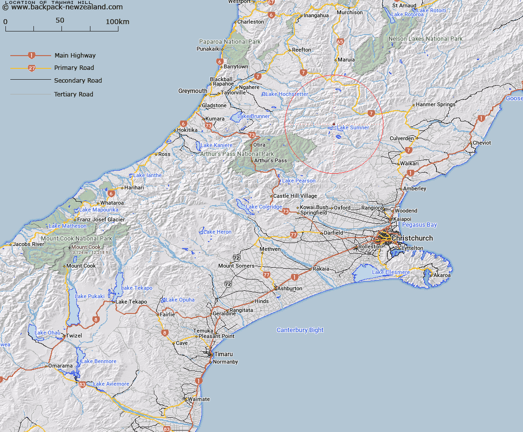
Map showing location of Tawhai Hill


LINZ description: A 1395m hill rising above the northern shores of Lake Sumner within the Lake Sumner Forest Park, in the foothills of Southern Alps / Kā Tiritiri o te Moana. NZTopo50-BU22 349757.
Latitude: -42.668361
Longitude: 172.206278
Northing: 5275706.7
Easting: 1534958
Land District: Canterbury
Feat Type: Hill


Scroll down to see a more detailed road map and below that a topographical map showing the location of Tawhai Hill. The road map has been supplied by openstreetmap and the topographical map of Tawhai Hill has been supplied by Land Information New Zealand (LINZ).

Yes you can use the top static map for you school/university project or personal website with a link back. Contact me for any commercial use.

Tawhai Hill Map New Zealand


New Zealand places in our database
[ A ] [ B ] [ C ] [ D ] [ E ] [ F ] [ G ] [ H ] [ I ] [ J ] [ K ] [ L ] [ M ] [ N ] [ O ] [ P ] [ Q ] [ R ] [ S ] [ T ] [ U ] [ V ] [ W ] [ X ] [ Y ] [ Z ]


Closest 20 Hills to Tawhai Hill

Macs Knob ( 5.64km )   Mount Emerson ( 5.7km )   Mount Longfellow ( 7.38km )   Neschacker Hill ( 9.3km )   Mount Edison ( 9.86km )   Isolated Hill ( 10.03km )   Dinner Hill ( 11.1km )   Conical Hill ( 11.73km )   Terrible Knob ( 11.77km )   Bell Knoll ( 12.34km )   Mount Garfield ( 12.69km )   Mount Lakeman ( 13.65km )   Mount Pan ( 13.76km )   Mount Murray ( 13.77km )   Little Sisters ( 14.11km )   Mount Ajax ( 14.43km )   Jollie Brook ( 15.34km )   Island Hills ( 16.18km )   Scaw Fell ( 16.96km )   Cherry Tree Hill ( 16.97km )   Mount Crossley ( 18.13km )   Mount Quail ( 18.37km )   Blake Peak ( 18.45km )   Mons Boreas ( 18.75km )   Mount Novaro ( 19.03km )   Mount Barron ( 19.19km )   Mount Carrington ( 19.43km )   Mount Skiddaw ( 19.87km )   Mount Tuke ( 20.02km )   The Devils Rampart ( 21.2km )   Garnet Peak ( 21.37km )   Mount Stapp ( 21.37km )   Mount Boscawen ( 21.54km )   Ben Cliberick ( 21.68km )   Esk Head ( 21.92km )   Top of the Ladder ( 22.3km )   Mount Miza ( 22.58km )   Balquether ( 22.69km )   La Grippe ( 22.79km )   Mount Hochstetter ( 22.93km )