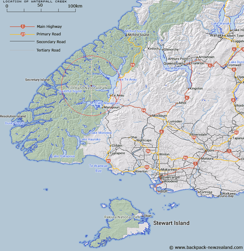
Map showing location of Waterfall Creek


LINZ description: Stream flowing south-easterly into South Fiord, Lake Te Anau, from an unnamed lake elevated 700m above Lake Te Anau.
Latitude: -45.29392
Longitude: 167.469495
Northing: 4969500
Easting: 1166352.7
Land District: Southland
Feat Type: Stream


Scroll down to see a more detailed road map and below that a topographical map showing the location of Waterfall Creek. The road map has been supplied by openstreetmap and the topographical map of Waterfall Creek has been supplied by Land Information New Zealand (LINZ).

Yes you can use the top static map for you school/university project or personal website with a link back. Contact me for any commercial use.

Waterfall Creek Map New Zealand


New Zealand places in our database
[ A ] [ B ] [ C ] [ D ] [ E ] [ F ] [ G ] [ H ] [ I ] [ J ] [ K ] [ L ] [ M ] [ N ] [ O ] [ P ] [ Q ] [ R ] [ S ] [ T ] [ U ] [ V ] [ W ] [ X ] [ Y ] [ Z ]


Closest 20 Streams to Waterfall Creek

Delta Burn ( 4.24km )   Chester Burn ( 4.72km )   Esk Burn ( 4.77km )   William Burn ( 5.78km )   McKenzie Burn ( 5.89km )   Gorge Burn ( 6.01km )   Plateau Creek ( 7.59km )   Tutu Burn ( 7.64km )   Lyall Burn ( 7.72km )   Philipson Burn ( 8.56km )   Sheerwall Creek ( 9.21km )   Wisely Burn ( 9.77km )   Mystery Burn ( 9.8km )   Forster Burn ( 10.09km )   Lake Creek ( 10.37km )   Adams Burn ( 10.5km )   Iris Burn ( 10.63km )   Point Burn ( 12.25km )   Woodrow Burn ( 12.26km )   Torre Stream ( 12.47km )   Stevens Burn ( 12.8km )   Freeman Burn ( 13.15km )   Ettrick Burn ( 13.15km )   Tuaraki Stream ( 13.61km )   Cozette Burn ( 13.64km )   Omaki Stream ( 13.94km )   Jennings Burn ( 14.26km )   Takahe Stream ( 14.56km )   Snag Burn ( 14.64km )   Gilmour Burn ( 14.94km )   Junction Burn ( 15.81km )   Forest Burn ( 17.62km )   Elaine Stream ( 17.68km )   Anehu Stream ( 18.12km )   Tunnel Burn ( 18.8km )   McIvor Burn ( 18.99km )   Wekawai Stream ( 19.48km )   Doon River ( 19.58km )   Coal Creek ( 19.61km )   Awe Burn ( 19.94km )