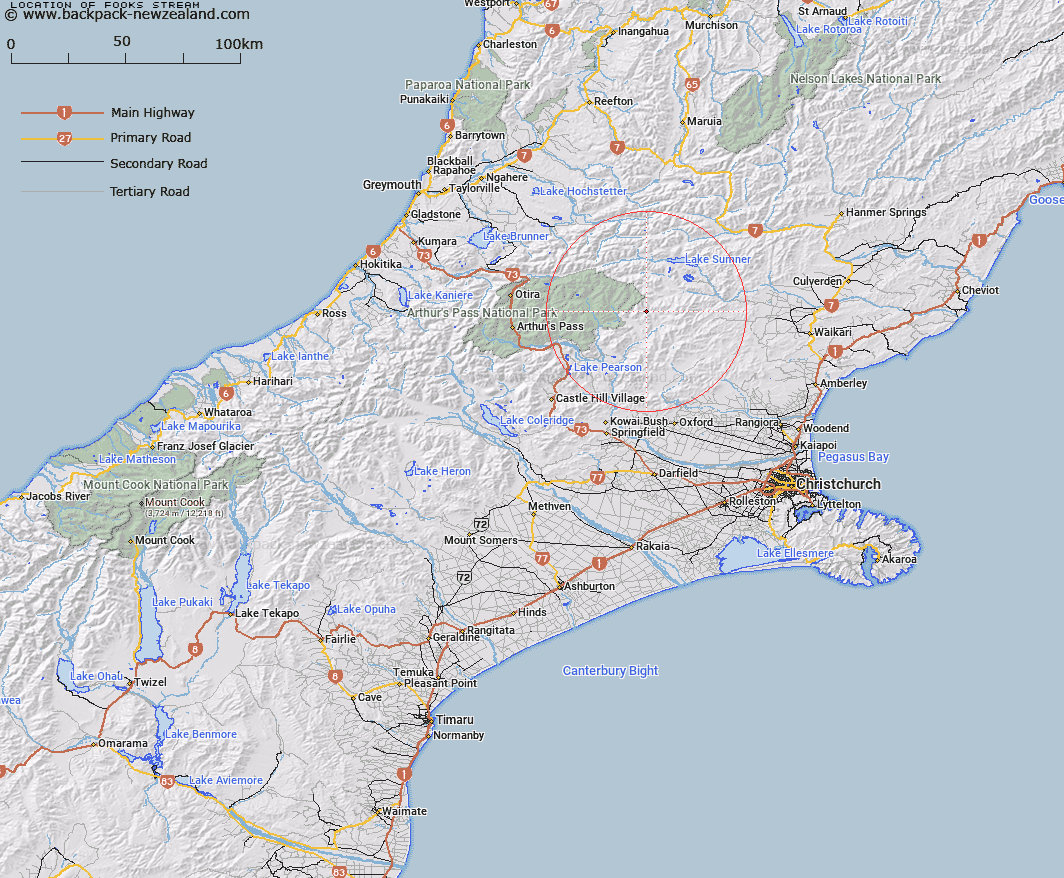
Map showing location of Fooks Stream


LINZ description: Left bank tributary of Ant Stream, rising 1.2km South-east of Mount Turnbull, flowing South-eastwards and joining Ant Stream 400m North of Ant Stream Hut. Block II Esk Survey District.
Latitude: -42.885418
Longitude: 172.08054
Northing: 5251499.2
Easting: 1524917
Land District: Canterbury
Feat Type: Stream


Scroll down to see a more detailed road map and below that a topographical map showing the location of Fooks Stream. The road map has been supplied by openstreetmap and the topographical map of Fooks Stream has been supplied by Land Information New Zealand (LINZ).

Yes you can use the top static map for you school/university project or personal website with a link back. Contact me for any commercial use.

Fooks Stream Map New Zealand


New Zealand places in our database
[ A ] [ B ] [ C ] [ D ] [ E ] [ F ] [ G ] [ H ] [ I ] [ J ] [ K ] [ L ] [ M ] [ N ] [ O ] [ P ] [ Q ] [ R ] [ S ] [ T ] [ U ] [ V ] [ W ] [ X ] [ Y ] [ Z ]


Closest 20 Streams to Fooks Stream

Fossil Stream ( 5.01km )   Anna Stream ( 5.44km )   Flora Stream ( 5.66km )   Ant Stream ( 6.05km )   Lucy Stream ( 6.14km )   Candlestick Stream ( 6.31km )   Nigger Stream ( 6.96km )   P?kio Stream ( 6.96km )   Crossley Stream ( 7.01km )   Bush Gully Stream ( 7.26km )   Lochinvar Stream ( 7.51km )   Anderson Stream ( 7.7km )   North Esk River ( 8.73km )   Bull Creek ( 8.98km )   Cochran Stream ( 9.21km )   Pig Spur Stream ( 9.3km )   Esk River ( 9.7km )   Woollies Stream ( 9.93km )   Grant Stream ( 10.42km )   Kennedy Stream ( 10.66km )   Beckett Stream ( 11.13km )   Camp Stream ( 11.13km )   Deep Stream ( 11.19km )   Cox River ( 11.51km )   Baldy Stream ( 12.35km )   Montgomery Stream ( 12.36km )   Row Stream ( 13.03km )   Lagoon Stream ( 13.09km )   Homestead Stream ( 13.09km )   Valley Stream ( 13.49km )   Ellis Stream ( 13.52km )   Cleland Stream ( 14.03km )   Stony Stream ( 14.45km )   Bridge Stream ( 14.57km )   Poulter River East Branch ( 14.7km )   Zig Zag Stream ( 14.71km )   Hungerford Stream ( 14.76km )   Zigzag Creek ( 14.78km )   Turnbull Stream ( 15.11km )   Laurie Stream ( 15.18km )