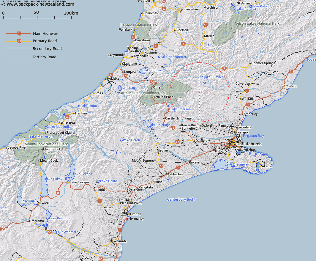
Map showing location of Anderson Stream


LINZ description: Rises on South side of Dampien Range. Flows south west into Esk River at Andersons Hutt.
Latitude: -42.882794
Longitude: 172.174943
Northing: 5251870.4
Easting: 1532623.1
Land District: Canterbury
Feat Type: Stream


Scroll down to see a more detailed road map and below that a topographical map showing the location of Anderson Stream. The road map has been supplied by openstreetmap and the topographical map of Anderson Stream has been supplied by Land Information New Zealand (LINZ).

Yes you can use the top static map for you school/university project or personal website with a link back. Contact me for any commercial use.

Anderson Stream Map New Zealand


New Zealand places in our database
[ A ] [ B ] [ C ] [ D ] [ E ] [ F ] [ G ] [ H ] [ I ] [ J ] [ K ] [ L ] [ M ] [ N ] [ O ] [ P ] [ Q ] [ R ] [ S ] [ T ] [ U ] [ V ] [ W ] [ X ] [ Y ] [ Z ]


Closest 20 Streams to Anderson Stream

Fossil Stream ( 3.52km )   Bush Gully Stream ( 3.57km )   Woollies Stream ( 4.8km )   Deep Stream ( 5.28km )   Lucy Stream ( 5.35km )   Grant Stream ( 5.93km )   Anna Stream ( 6.32km )   Valley Stream ( 6.9km )   Bridge Stream ( 7.14km )   Fooks Stream ( 7.7km )   Ant Stream ( 8.07km )   Zig Zag Stream ( 8.16km )   Waterfall Stream ( 8.22km )   Zigzag Creek ( 8.27km )   Crossley Stream ( 8.35km )   Pig Spur Stream ( 8.69km )   Whitnow Stream ( 8.75km )   Clay Spur Stream ( 9.09km )   Homestead Stream ( 9.43km )   Seaward River ( 10.23km )   Trumper Stream ( 10.33km )   Hut Branch ( 10.48km )   Flora Stream ( 10.55km )   North Esk River ( 10.58km )   Woolshed Stream ( 11.04km )   Kennedy Stream ( 11.1km )   Panhandle Stream ( 11.72km )   Esk River ( 11.8km )   Whistling Creek ( 11.8km )   Candlestick Stream ( 11.81km )   Flax Stream ( 12.23km )   Dust Stream ( 12.67km )   Laurie Stream ( 12.89km )   Bull Stream ( 13.03km )   P?kio Stream ( 13.19km )   Nigger Stream ( 13.19km )   Bull Creek ( 13.21km )   Duncan Stream ( 13.28km )   Lagoon Stream ( 13.32km )   Virginia Stream ( 13.4km )