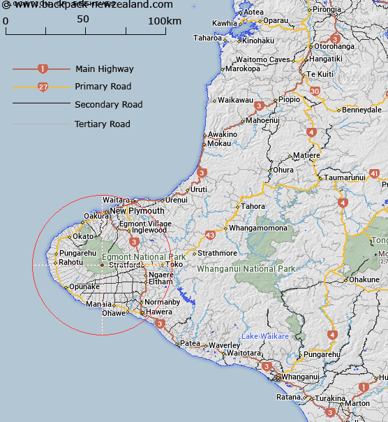
Map showing location of Beehives
LINZ description: located on the south side of Mount Taranaki between the Otakeho Stream and Cold Stream
Latitude: -39.337285
Longitude: 174.059004
Northing: 5645258.8
Easting: 1691265.1
Land District: Taranaki
Feat Type: Trig Station
Latitude: -39.337285
Longitude: 174.059004
Northing: 5645258.8
Easting: 1691265.1
Land District: Taranaki
Feat Type: Trig Station

Scroll down to see a more detailed road map and below that a topographical map showing the location of Beehives. The road map has been supplied by openstreetmap and the topographical map of Beehives has been supplied by Land Information New Zealand (LINZ).
Yes you can use the top static map for you school/university project or personal website with a link back. Contact me for any commercial use.
[ A ] [ B ] [ C ] [ D ] [ E ] [ F ] [ G ] [ H ] [ I ] [ J ] [ K ] [ L ] [ M ] [ N ] [ O ] [ P ] [ Q ] [ R ] [ S ] [ T ] [ U ] [ V ] [ W ] [ X ] [ Y ] [ Z ]