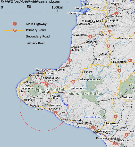
Map showing location of Waimate


LINZ description: Trig Station located on top of a 103m high hill, 2.5km south of Okaiawa and 8 west of Hawera.
Latitude: -39.554554
Longitude: 174.194232
Northing: 5621000
Easting: 1702600
Land District: Taranaki
Feat Type: Trig Station


Scroll down to see a more detailed road map and below that a topographical map showing the location of Waimate. The road map has been supplied by openstreetmap and the topographical map of Waimate has been supplied by Land Information New Zealand (LINZ).

Yes you can use the top static map for you school/university project or personal website with a link back. Contact me for any commercial use.

Waimate Map New Zealand


New Zealand places in our database
[ A ] [ B ] [ C ] [ D ] [ E ] [ F ] [ G ] [ H ] [ I ] [ J ] [ K ] [ L ] [ M ] [ N ] [ O ] [ P ] [ Q ] [ R ] [ S ] [ T ] [ U ] [ V ] [ W ] [ X ] [ Y ] [ Z ]


Closest 20 Trig Stations to Waimate

Araukuku ( 11.33km )   Awatuna ( 18.66km )   Clement ( 26.46km )   Beehives ( 26.8km )   Urekawa ( 31.53km )   Putahi ( 34.98km )   Raven ( 39.57km )   Patuha ( 47.94km )   Weraroa ( 54.54km )   Onaeroa ( 63.68km )   Onaero ( 63.68km )   Mangamaio ( 67.06km )   Mangamaeho ( 67.06km )   Papaumu ( 92.75km )   Mangamahu ( 112.37km )   Parawanui ( 121.95km )   Parewanui ( 121.95km )   Mount Misery ( 125.77km )   Oruarongo ( 138.18km )   Parikawau ( 143.88km )   Hepipi ( 150.07km )   Heipipi ( 150.07km )   Tuteremoana ( 156.33km )   Thunderbolt ( 156.96km )   Motuoapa ( 159.95km )   Ross ( 161.34km )   Wharite ( 161.92km )   Matanginui ( 163.22km )   Matanganui ( 163.22km )   Kawhatau ( 164.45km )   Mangaweka ( 164.45km )   Taramea ( 164.81km )   Taramia ( 164.81km )   Ngapuketurua ( 165.76km )   Ngapuketarua ( 165.76km )   Tawake Tohunga ( 165.9km )   Tawheketewhango ( 165.9km )   Tawai-Tohunga ( 165.9km )   Tauwheketewhango ( 165.9km )   Pukemoremore ( 168.07km )