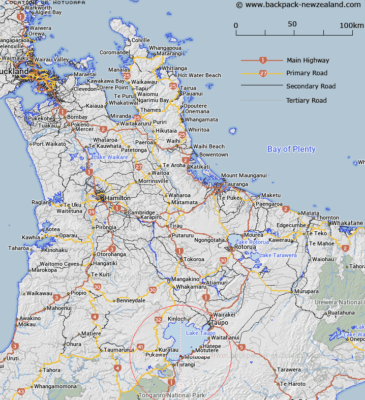
Map showing location of Motuoapa
LINZ description: Trig station on hill on Motuoapa Peninsula. Block III Tokaanu Survey District. Geodetic code: 2368
Latitude: -38.921555
Longitude: 175.861989
Northing: 5688033.4
Easting: 1848120
Land District: South Auckland
Feat Type: Trig Station
Latitude: -38.921555
Longitude: 175.861989
Northing: 5688033.4
Easting: 1848120
Land District: South Auckland
Feat Type: Trig Station

Scroll down to see a more detailed road map and below that a topographical map showing the location of Motuoapa. The road map has been supplied by openstreetmap and the topographical map of Motuoapa has been supplied by Land Information New Zealand (LINZ).
Yes you can use the top static map for you school/university project or personal website with a link back. Contact me for any commercial use.
[ A ] [ B ] [ C ] [ D ] [ E ] [ F ] [ G ] [ H ] [ I ] [ J ] [ K ] [ L ] [ M ] [ N ] [ O ] [ P ] [ Q ] [ R ] [ S ] [ T ] [ U ] [ V ] [ W ] [ X ] [ Y ] [ Z ]