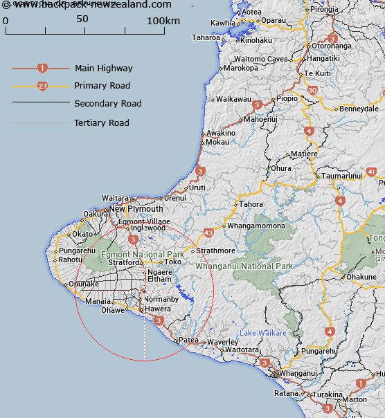
Map showing location of Araukuku


LINZ description: A trig code A728 NZGD 2000 order 5 SS pin in 50mm iron pipe
Latitude: -39.491274
Longitude: 174.297807
Northing: 5627900
Easting: 1711600
Land District: Taranaki
Feat Type: Trig Station


Scroll down to see a more detailed road map and below that a topographical map showing the location of Araukuku. The road map has been supplied by openstreetmap and the topographical map of Araukuku has been supplied by Land Information New Zealand (LINZ).

Yes you can use the top static map for you school/university project or personal website with a link back. Contact me for any commercial use.

Araukuku Map New Zealand


New Zealand places in our database
[ A ] [ B ] [ C ] [ D ] [ E ] [ F ] [ G ] [ H ] [ I ] [ J ] [ K ] [ L ] [ M ] [ N ] [ O ] [ P ] [ Q ] [ R ] [ S ] [ T ] [ U ] [ V ] [ W ] [ X ] [ Y ] [ Z ]


Closest 20 Trig Stations to Araukuku

Waimate ( 11.33km )   Karimoi ( 11.33km )   Awatuna ( 22.96km )   Beehives ( 26.72km )   Urekawa ( 30.57km )   Clement ( 30.94km )   Putahi ( 33.46km )   Raven ( 41.03km )   Patuha ( 46.5km )   Weraroa ( 51.49km )   Onaeroa ( 55.3km )   Onaero ( 55.3km )   Mangamaeho ( 57.3km )   Mangamaio ( 57.3km )   Papaumu ( 81.42km )   Mangamahu ( 105.48km )   Mount Misery ( 116.31km )   Parewanui ( 119.87km )   Parawanui ( 119.87km )   Parikawau ( 132.68km )   Oruarongo ( 138.2km )   Hepipi ( 140.5km )   Heipipi ( 140.5km )   Thunderbolt ( 146.66km )   Motuoapa ( 148.92km )   Tauwheketewhango ( 156km )   Tawheketewhango ( 156km )   Tawai-Tohunga ( 156km )   Tawake Tohunga ( 156km )   Ross ( 157.02km )   Kawhatau ( 157.28km )   Mangaweka ( 157.28km )   Wharite ( 157.96km )   Matanginui ( 158.57km )   Matanganui ( 158.57km )   Tuteremoana ( 159.74km )   Paemutu ( 161.42km )   Remutupo ( 161.46km )   Waikamaka ( 161.46km )   Te Atuaoparapara ( 161.71km )