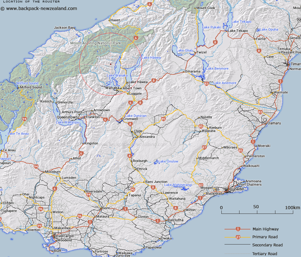
Map showing location of The Rouster


LINZ description: Hill above Rough Burn on western shore of Lake Wanaka, 6km north west of Minaret Bay.
Latitude: -44.394893
Longitude: 169.059946
Northing: 5076711.5
Easting: 1286206.9
Land District: Otago
Feat Type: Hill


Scroll down to see a more detailed road map and below that a topographical map showing the location of The Rouster. The road map has been supplied by openstreetmap and the topographical map of The Rouster has been supplied by Land Information New Zealand (LINZ).

Yes you can use the top static map for you school/university project or personal website with a link back. Contact me for any commercial use.

The Rouster Map New Zealand


New Zealand places in our database
[ A ] [ B ] [ C ] [ D ] [ E ] [ F ] [ G ] [ H ] [ I ] [ J ] [ K ] [ L ] [ M ] [ N ] [ O ] [ P ] [ Q ] [ R ] [ S ] [ T ] [ U ] [ V ] [ W ] [ X ] [ Y ] [ Z ]


Closest 20 Hills to The Rouster

The White ( 2.38km )   Pykes Hill ( 6.14km )   Mount Albert ( 7.77km )   Twin Peaks ( 10.23km )   Mount Gilbert ( 12.23km )   Camp Peaks ( 13.38km )   Isthmus Peak ( 13.46km )   Mount Jumbo ( 13.49km )   Triple Peak ( 13.63km )   Sentinel Peak ( 13.79km )   Mount Alta ( 13.93km )   Dragonfly Peak ( 14.43km )   Black Hill ( 15.78km )   Ote Koti Koko ( 15.79km )   Aspinall Peak ( 16.38km )   Lois Peak ( 16.83km )   Mount Eostre ( 16.86km )   Mount Twilight ( 17.1km )   Mount White ( 17.16km )   Tyrwhitt Peak ( 17.69km )   Sisyphus Peak ( 18.21km )   Mount Arne ( 18.49km )   Mount Perseus ( 18.9km )   Oblong Peak ( 19.11km )   Mount Aeolus ( 19.11km )   Mount Broome ( 19.17km )   Mount Constitution ( 19.62km )   Mount Turner ( 19.7km )   Pickelhaube ( 19.86km )   Pickelhaube Peak ( 19.92km )   Mount Vesta ( 20km )   Mount Burke ( 20.09km )   Fastness Peak ( 20.31km )   Mount Taunus ( 20.7km )   Mount Taurus ( 20.7km )   Mount Iphigenia ( 20.81km )   Duncans Knob ( 21km )   Glacier Dome ( 21.1km )   Mount Ernest ( 21.12km )   Mount Betsy Jane ( 21.21km )