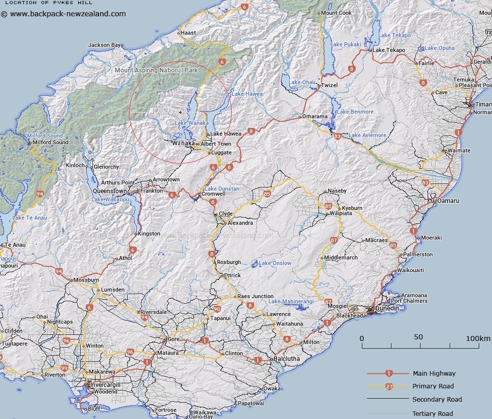
Map showing location of Pykes Hill


LINZ description: Hill above Bells Creek on western shore of Lake Wanaka.
Latitude: -44.45008
Longitude: 169.057026
Northing: 5070570
Easting: 1286270
Land District: Otago
Feat Type: Hill


Scroll down to see a more detailed road map and below that a topographical map showing the location of Pykes Hill. The road map has been supplied by openstreetmap and the topographical map of Pykes Hill has been supplied by Land Information New Zealand (LINZ).

Yes you can use the top static map for you school/university project or personal website with a link back. Contact me for any commercial use.

Pykes Hill Map New Zealand


New Zealand places in our database
[ A ] [ B ] [ C ] [ D ] [ E ] [ F ] [ G ] [ H ] [ I ] [ J ] [ K ] [ L ] [ M ] [ N ] [ O ] [ P ] [ Q ] [ R ] [ S ] [ T ] [ U ] [ V ] [ W ] [ X ] [ Y ] [ Z ]


Closest 20 Hills to Pykes Hill

Twin Peaks ( 4.18km )   The White ( 4.53km )   The Rouster ( 6.14km )   Mount Alta ( 8.97km )   Ote Koti Koko ( 9.65km )   Black Hill ( 9.9km )   Triple Peak ( 10.19km )   Isthmus Peak ( 11.44km )   Tyrwhitt Peak ( 11.62km )   Mount Albert ( 13.85km )   Dragonfly Peak ( 14.83km )   Sentinel Peak ( 14.97km )   Mount Burke ( 15.09km )   Camp Peaks ( 15.78km )   Mount Eostre ( 15.85km )   Lookout Hill ( 16.32km )   Mount Gold ( 16.35km )   Mount Gilbert ( 18.12km )   Niger Peak ( 18.68km )   Mount Jumbo ( 19.16km )   Sisyphus Peak ( 19.66km )   Aspinall Peak ( 20.12km )   Duncans Knob ( 20.64km )   Lois Peak ( 20.76km )   Mount Maude ( 21.25km )   Glenfinnan Peak ( 21.34km )   Mount Twilight ( 21.35km )   Mount White ( 21.44km )   Fog Peak ( 21.6km )   Fastness Peak ( 22.02km )   Mildewed Meg ( 22.75km )   Pickelhaube ( 22.9km )   Pickelhaube Peak ( 22.95km )   Corner Peak ( 23.05km )   Moncrieff Peak ( 23.23km )   Black Peak ( 23.27km )   Homestead Peak ( 23.27km )   Glacier Dome ( 23.51km )   Mount Brown ( 23.68km )   Mount Arne ( 23.79km )