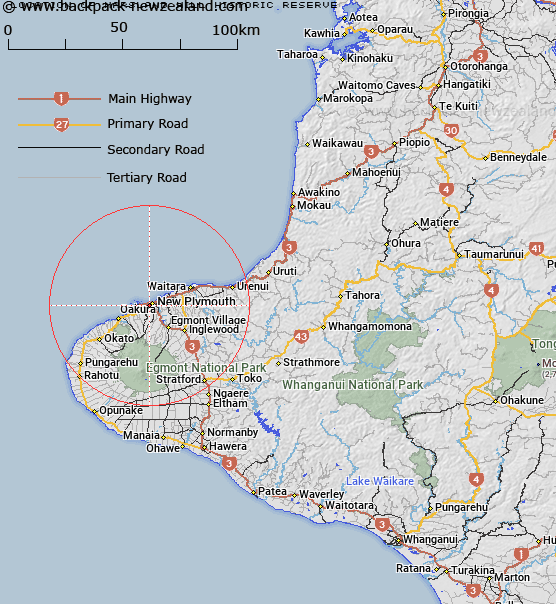
Map showing location of Marsland Hill Historic Reserve


LINZ description: 3.132 hectares, being Section 2459 Town of New Plymouth
Latitude: -39.064866
Longitude: 174.073948
Northing: 5675476.4
Easting: 1692911.2
Land District: Taranaki
Feat Type: Historic Reserve


Scroll down to see a more detailed road map and below that a topographical map showing the location of Marsland Hill Historic Reserve. The road map has been supplied by openstreetmap and the topographical map of Marsland Hill Historic Reserve has been supplied by Land Information New Zealand (LINZ).

Yes you can use the top static map for you school/university project or personal website with a link back. Contact me for any commercial use.

Marsland Hill Historic Reserve Map New Zealand


New Zealand places in our database
[ A ] [ B ] [ C ] [ D ] [ E ] [ F ] [ G ] [ H ] [ I ] [ J ] [ K ] [ L ] [ M ] [ N ] [ O ] [ P ] [ Q ] [ R ] [ S ] [ T ] [ U ] [ V ] [ W ] [ X ] [ Y ] [ Z ]


Closest 20 Historic Reserves to Marsland Hill Historic Reserve

Puketarata-Parihamore Historic Reserve ( 1.69km )   Omata Stockade Historic Reserve ( 4.67km )   Taumata Historic Reserve ( 8.7km )   Te Koru Pa Historic Reserve ( 10.25km )   Sentry Hill Redoubt Historic Reserve ( 10.99km )   Mahoetahi Historic Reserve ( 11.53km )   Puketakauere Pa Historic Reserve ( 14.52km )   Pukerangiora Pa Historic Reserve ( 16.4km )   Tataraimaka Urup? Historic Reserve ( 17.58km )   Tataraimaka Pa Historic Reserve ( 17.58km )   St George's Redoubt Historic Reserve ( 17.72km )   Tataraimaka / St George’s Redoubt Historic Reserve ( 17.72km )   Awa te Take Pa Historic Reserve ( 18.17km )   Tapuinikau Pa Historic Reserve ( 28.99km )   Pou Tehia Historic Reserve ( 52.93km )   Kawau Pa Historic Reserve ( 56.33km )   Puketapu Historic Reserve ( 103.96km )   Moutoa Gardens Historic Reserve ( 128.08km )   Puraho Historic Reserve ( 134.34km )   Kakepuku Mountain Historic Reserve ( 150.73km )   Paterangi Historic Reserve ( 157.63km )   Selwyn Park Historic Reserve ( 160.25km )   Tikirere Mill Race Historic Reserve ( 165.21km )   Gudex Memorial Park Historic Reserve ( 184.54km )   Opepe Bush Scenic & Historic Reserve ( 188.62km )   Rangiriri Pa Historic Reserve ( 204.04km )   Te Wheoro's Redoubt Historic Reserve ( 204.08km )   Taniwha Pa Historic Reserve ( 211.76km )   Cameron Town Historic Reserve ( 212.34km )   Meremere Pa Site Historic Reserve ( 212.83km )   Whangamarino Redoubt Historic Reserve ( 215.13km )   Parapara Peninsula Historic Reserve ( 218.54km )   Waiau Pa Historic Reserve ( 219.78km )   Shield's Flat Stone Walls Historic Reserve ( 221.49km )   Ship Cove Historic Reserve ( 226.55km )   Pratts Road Historic Reserve ( 228.28km )   Maungaruahine Pa Historic Reserve ( 233.96km )   Gate Pa Historic Reserve ( 234.25km )   Gerald Crapp Historic Reserve ( 235.2km )   Victoria Battery Historic Reserve ( 236.25km )